San Miguel Ecatepec geodata
San Miguel Ecatepec (Oaxaca) is a populated place; located in Mexico in America/Mexico_City (GMT-6) time zone. With population of 752 people, there are 11651 cities with bigger population in this country. Compared to other cities in Mexico, 96% of cities are located further ↑North; 82.8% of cities are located further ←West and 70% of cities have higher elevation than San Miguel Ecatepec. Note1


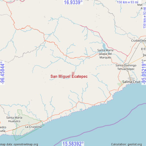
San Miguel Ecatepec GPS coordinates[2]
16° 15' 36.252" North, 95° 45' 19.116" West
| Map corner | latitude | longitude |
|---|---|---|
| Upper-left | 16.9339°, | -96.45844° |
| Center: | 16.26007°, | -95.75531° |
| Lower-right: | 15.58392°, | -95.05219° |
| Map W x H: | 150.1×150.1 km | = 93.3×93.3mi |
| max Lat: | 32.7° ⇑96% North |
| San Miguel Ecatepec: | 16.26007° |
| min Lat: | ⇓4% South 14.53588° |
| min Long | San Miguel Ecat | max Long |
| -117.105° | -95.75531° | -86.73105° |
| W 82.8%⇐ | ⇒17.2% E |
Elevation
Elevation of San Miguel Ecatepec is 418 m = 1371 ft, and this is 835.7 m = 2742 ft below average elevation for this country.
| Max E: |
3497 m = 11473 ft | 70% |
| Avg. | 1253.7 m = 4113 ft | |
| San Miguel Ecatepec | 418 m = 1371 ft | |
Min E: |
-1 m = -3 ft | 30% |
See also: Mexico elevation on elevation.city.
Geographical zone
San Miguel Ecatepec is located in North Torrid zone (between Equator and Tropic of Cancer). Distance of this Northern Tropic circle is 798 km =495.9 mi to North.| Distance of | km | miles | from San Miguel Ecatepec |
|---|---|---|---|
| North Pole | 8199.1 | 5094.7 | to North |
| Arctic Circle | 5593.2 | 3475.5 | to North |
| Tropic Cancer | 798 | 495.9 | to North |
| Equator | 1808 | 1123.4 | to South |


Nearby cities:
15 places around San Miguel Ecatepec: (largest is in red/bold)
• Asunción Tlacolulita
5.3 km =3.3 mi,  34°
34°
• Guadalupe Victoria
30.6 km =19 mi,  207°
207°
• Magdalena Tequisistlán
22.5 km =14 mi,  46°
46°
• San Bartolo Yautepec
30 km =18.6 mi,  308°
308°
• San Cristóbal
31.5 km =19.6 mi, 49°
• San Matías Petacaltepec
17 km =10.6 mi,  235°
235°
• San Miguel Tenango
17.1 km =10.6 mi,  87°
87°
• San Pablo Topiltepec
30 km =18.6 mi,  252°
252°
• San Pedro Huamelula
27.6 km =17.1 mi,  160°
160°
• Santa María Ecatepec
13.6 km =8.5 mi,  281°
281°
• Santa María Huamelula
30.3 km =18.8 mi,  169°
169°
• Santa María Quiegolani
31.8 km =19.8 mi,  273°
273°
• Santa María Zapotitlán
18 km =11.2 mi,  215°
215°
• Santiago Astata
31.5 km =19.6 mi, 164°
• Tapanalá
32.8 km =20.4 mi, 174°
Sources, notices
• [Note1] Compared only with cities in Mexico existing in our database
• [Src1] Map data: © OpenStreetMap contributors (CC-BY-SA)
• [Src2] Other city data from geonames.org with taken over terms of usage.
• [Src3] Geographical zone / Annual Mean Temperature by Robert A. Rohde @ Wikipedia
