San Simonito geodata
San Simonito (State of Mexico) is a populated place; located in Mexico in America/Mexico_City (GMT-6) time zone. With population of 2,028 people, there are 4292 cities with bigger population in this country. Compared to other cities in Mexico, 64.9% of cities are located further ↑North; 57.4% of cities are located further →East and 79.4% of cities have lower elevation than San Simonito. Note1


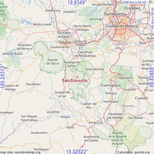
San Simonito GPS coordinates[2]
18° 59' 29.004" North, 99° 32' 24" West
| Map corner | latitude | longitude |
|---|---|---|
| Upper-left | 19.6549°, | -100.24313° |
| Center: | 18.99139°, | -99.54° |
| Lower-right: | 18.32522°, | -98.83688° |
| Map W x H: | 147.8×147.8 km | = 91.8×91.8mi |
| max Lat: | 32.7° ⇑64.9% North |
| San Simonito: | 18.99139° |
| min Lat: | ⇓35.1% South 14.53588° |
| min Long | San Simonito | max Long |
| -117.105° | -99.54° | -86.73105° |
| W 42.6%⇐ | ⇒57.4% E |
Elevation
Elevation of San Simonito is 2125 m = 6972 ft, and this is 871.3 m = 2859 ft above average elevation for this country.
| Max E: |
3497 m = 11473 ft | 20.6% |
| San Simonito | 2125 m 6972 ft | |
| Avg. | 1253.7 m = 4113 ft | |
Min E: |
-1 m = -3 ft | 79.4% |
See also: Mexico elevation on elevation.city.
Geographical zone
San Simonito is located in North Torrid zone (between Equator and Tropic of Cancer). Distance of this Northern Tropic circle is 494.3 km =307.1 mi to North.| Distance of | km | miles | from San Simonito |
|---|---|---|---|
| North Pole | 7895.4 | 4906 | to North |
| Arctic Circle | 5289.5 | 3286.7 | to North |
| Tropic Cancer | 494.3 | 307.1 | to North |
| Equator | 2111.6 | 1312.1 | to South |


Nearby cities:
15 places around San Simonito: (largest is in red/bold)
• Chalchihuapan
4 km =2.5 mi,  246°
246°
• Colonia Emiliano Zapata Ejido de Tenancingo
4.6 km =2.9 mi,  205°
205°
• Colonia San Ramón
4.2 km =2.6 mi,  232°
232°
• Ejido de Tenería (El Llano)
4.7 km =2.9 mi,  216°
216°
• La Mesita
4.5 km =2.8 mi,  257°
257°
• La Trinidad
5.1 km =3.2 mi,  237°
237°
• Maxtleca de Galeana
4.5 km =2.8 mi,  336°
336°
• San Gabriel Zepayautla
2.7 km =1.7 mi,  332°
332°
• San José Tenería (Tenería)
4.6 km =2.9 mi,  184°
184°
• San Juan Tetitlán
3.8 km =2.4 mi, 236°
• San Juan Xochiaca
2.5 km =1.6 mi,  1°
1°
• San Martín Coapaxtongo
3.2 km =2 mi,  275°
275°
• San Miguel Tecomatlán
1.9 km =1.2 mi,  140°
140°
• San Simón el Alto
3.9 km =2.4 mi,  81°
81°
• Tepoxtepec
3.6 km =2.2 mi, 208°
Sources, notices
• [Note1] Compared only with cities in Mexico existing in our database
• [Src1] Map data: © OpenStreetMap contributors (CC-BY-SA)
• [Src2] Other city data from geonames.org with taken over terms of usage.
• [Src3] Geographical zone / Annual Mean Temperature by Robert A. Rohde @ Wikipedia
