San Miguel Tecomatlán geodata
San Miguel Tecomatlán (State of Mexico) is a populated place; located in Mexico in America/Mexico_City (GMT-6) time zone. With population of 3,180 people, there are 2839 cities with bigger population in this country. Compared to other cities in Mexico, 65.1% of cities are located further ↑North; 57.3% of cities are located further →East and 77.9% of cities have lower elevation than San Miguel Tecomatlán. Note1
Current local time in San Miguel Tecomatlán:
06:51 AM, WednesdayDifference from your time zone: hours


San Miguel Tecomatlán GPS coordinates[2]
18° 58' 41.988" North, 99° 31' 42.996" West
| Map corner | latitude | longitude |
|---|---|---|
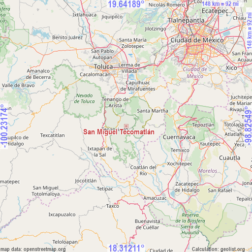
| Upper-left | 19.64189°, | -100.23174° |
| Center: | 18.97833°, | -99.52861° |
| Lower-right: | 18.31211°, | -98.82549° |
| Map W x H: | 147.9×147.9 km | = 91.9×91.9mi |
| max Lat: | 32.7° ⇑65.1% North |
| San Miguel Tecomatlán: | 18.97833° |
| min Lat: | ⇓34.9% South 14.53588° |
| min Long | San Miguel Teco | max Long |
| -117.105° | -99.52861° | -86.73105° |
| W 42.7%⇐ | ⇒57.3% E |
Elevation
Elevation of San Miguel Tecomatlán is 2087 m = 6847 ft, and this is 833.3 m = 2734 ft above average elevation for this country.
| Max E: |
3497 m = 11473 ft | 22.1% |
| San Miguel Tecomatlán | 2087 m 6847 ft | |
| Avg. | 1253.7 m = 4113 ft | |
Min E: |
-1 m = -3 ft | 77.9% |
See also: Mexico elevation on elevation.city.
Geographical zone
San Miguel Tecomatlán is located in North Torrid zone (between Equator and Tropic of Cancer). Distance of this Northern Tropic circle is 495.7 km =308 mi to North.| Distance of | km | miles | from San Miguel Tecomatlán |
|---|---|---|---|
| North Pole | 7896.9 | 4906.9 | to North |
| Arctic Circle | 5291 | 3287.7 | to North |
| Tropic Cancer | 495.7 | 308 | to North |
| Equator | 2110.2 | 1311.2 | to South |


Nearby cities:
15 places around San Miguel Tecomatlán: (largest is in red/bold)
• Chalchihuapan
4.9 km =3 mi,  268°
268°
• Colonia Emiliano Zapata Ejido de Tenancingo
4.2 km =2.6 mi,  229°
229°
• Colonia San Ramón
4.7 km =2.9 mi,  256°
256°
• Ejido de Tenería (El Llano)
4.6 km =2.9 mi,  239°
239°
• Malinalco
4.8 km =3 mi,  134°
134°
• San Gabriel Zepayautla
4.6 km =2.9 mi,  327°
327°
• San José Tenería (Tenería)
3.5 km =2.2 mi,  205°
205°
• San Juan Tetitlán
4.4 km =2.7 mi, 261°
• San Juan Xochiaca
4.1 km =2.5 mi,  343°
343°
• San Martín Coapaxtongo
4.7 km =2.9 mi,  292°
292°
• San Nicolás
3.6 km =2.2 mi,  98°
98°
• San Sebastián
4.9 km =3 mi,  87°
87°
• San Simonito
1.9 km =1.2 mi,  320°
320°
• San Simón el Alto
3.3 km =2.1 mi,  52°
52°
• Tepoxtepec
3.4 km =2.1 mi, 239°
Sources, notices
• [Note1] Compared only with cities in Mexico existing in our database
• [Src1] Map data: © OpenStreetMap contributors (CC-BY-SA)
• [Src2] Other city data from geonames.org with taken over terms of usage.
• [Src3] Geographical zone / Annual Mean Temperature by Robert A. Rohde @ Wikipedia
