San Pedro Yólox geodata
San Pedro Yólox (Oaxaca) is a seat of a second-order administrative division; located in Mexico in America/Mexico_City (GMT-6) time zone. With population of 763 people, there are 11483 cities with bigger population in this country. Compared to other cities in Mexico, 82.3% of cities are located further ↑North; 79.4% of cities are located further ←West and 69.8% of cities have lower elevation than San Pedro Yólox. Note1


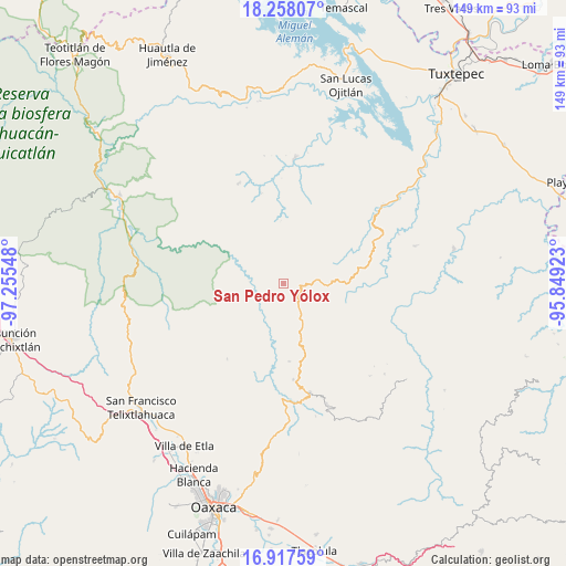
San Pedro Yólox GPS coordinates[2]
17° 35' 20.652" North, 96° 33' 8.46" West
| Map corner | latitude | longitude |
|---|---|---|
| Upper-left | 18.25807°, | -97.25548° |
| Center: | 17.58907°, | -96.55235° |
| Lower-right: | 16.91759°, | -95.84923° |
| Map W x H: | 149×149 km | = 92.6×92.6mi |
| max Lat: | 32.7° ⇑82.3% North |
| San Pedro Yólox: | 17.58907° |
| min Lat: | ⇓17.7% South 14.53588° |
| min Long | San Pedro Yólo | max Long |
| -117.105° | -96.55235° | -86.73105° |
| W 79.4%⇐ | ⇒20.6% E |
Elevation
Elevation of San Pedro Yólox is 1920 m = 6299 ft, and this is 666.3 m = 2186 ft above average elevation for this country.
| Max E: |
3497 m = 11473 ft | 30.2% |
| San Pedro Yólox | 1920 m 6299 ft | |
| Avg. | 1253.7 m = 4113 ft | |
Min E: |
-1 m = -3 ft | 69.8% |
See also: Mexico elevation on elevation.city.
Geographical zone
San Pedro Yólox is located in North Torrid zone (between Equator and Tropic of Cancer). Distance of this Northern Tropic circle is 650.2 km =404 mi to North.| Distance of | km | miles | from San Pedro Yólox |
|---|---|---|---|
| North Pole | 8051.3 | 5002.8 | to North |
| Arctic Circle | 5445.5 | 3383.7 | to North |
| Tropic Cancer | 650.2 | 404 | to North |
| Equator | 1955.7 | 1215.2 | to South |


Nearby cities:
15 places around San Pedro Yólox: (largest is in red/bold)
• El Porvenir
27.9 km =17.3 mi,  256°
256°
• San Isidro Aloápam
20.5 km =12.7 mi,  212°
212°
• San Juan Atepec
17.9 km =11.1 mi,  175°
175°
• San Juan Luvina
9.4 km =5.8 mi, 178°
• San Juan Quiotepec
4 km =2.5 mi,  290°
290°
• San Juan Teponaxtla
22.9 km =14.2 mi,  308°
308°
• San Juan Zapotitlán
24.7 km =15.3 mi,  346°
346°
• San Miguel Abejones
17.9 km =11.1 mi,  199°
199°
• San Miguel Aloápam
24.7 km =15.3 mi,  216°
216°
• San Pablo Macuiltianguis
6.2 km =3.9 mi, 179°
• Santa Ana Yaremi
22.3 km =13.9 mi, 196°
• Santa María Jaltianguis
25.2 km =15.7 mi,  174°
174°
• Santiago Comaltepec
2.7 km =1.7 mi, 171°
• Santiago Tlatepusco
26.6 km =16.5 mi,  9°
9°
• Teococuilco de Marcos Pérez
27.1 km =16.8 mi,  194°
194°
Sources, notices
• [Note1] Compared only with cities in Mexico existing in our database
• [Src1] Map data: © OpenStreetMap contributors (CC-BY-SA)
• [Src2] Other city data from geonames.org with taken over terms of usage.
• [Src3] Geographical zone / Annual Mean Temperature by Robert A. Rohde @ Wikipedia
