San Pedro Teutila geodata
San Pedro Teutila (Oaxaca) is a populated place; located in Mexico in America/Mexico_City (GMT-6) time zone. With population of 1,030 people, there are 8462 cities with bigger population in this country. Compared to other cities in Mexico, 78.9% of cities are located further ↑North; 78.3% of cities are located further ←West and 59.1% of cities have higher elevation than San Pedro Teutila. Note1


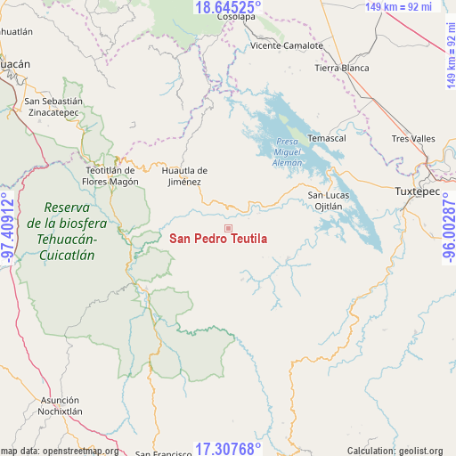
San Pedro Teutila GPS coordinates[2]
17° 58' 39.828" North, 96° 42' 21.564" West
| Map corner | latitude | longitude |
|---|---|---|
| Upper-left | 18.64525°, | -97.40912° |
| Center: | 17.97773°, | -96.70599° |
| Lower-right: | 17.30768°, | -96.00287° |
| Map W x H: | 148.7×148.7 km | = 92.4×92.4mi |
| max Lat: | 32.7° ⇑78.9% North |
| San Pedro Teutila: | 17.97773° |
| min Lat: | ⇓21.1% South 14.53588° |
| min Long | San Pedro Teuti | max Long |
| -117.105° | -96.70599° | -86.73105° |
| W 78.3%⇐ | ⇒21.7% E |
Elevation
Elevation of San Pedro Teutila is 1044 m = 3425 ft, and this is 209.7 m = 688 ft below average elevation for this country.
| Max E: |
3497 m = 11473 ft | 59.1% |
| Avg. | 1253.7 m = 4113 ft | |
| San Pedro Teutila | 1044 m = 3425 ft | |
Min E: |
-1 m = -3 ft | 40.9% |
See also: Mexico elevation on elevation.city.
Geographical zone
San Pedro Teutila is located in North Torrid zone (between Equator and Tropic of Cancer). Distance of this Northern Tropic circle is 607 km =377.2 mi to North.| Distance of | km | miles | from San Pedro Teutila |
|---|---|---|---|
| North Pole | 8008.1 | 4976 | to North |
| Arctic Circle | 5402.2 | 3356.8 | to North |
| Tropic Cancer | 607 | 377.2 | to North |
| Equator | 1998.9 | 1242.1 | to South |


Nearby cities:
15 places around San Pedro Teutila: (largest is in red/bold)
• Chiquihuitlán de Benito Juárez
4.6 km =2.9 mi,  296°
296°
• Cueyamecalco Villa de Zaragoza
13.4 km =8.3 mi,  264°
264°
• El Camarón
14 km =8.7 mi,  313°
313°
• La Soledad Piedra Ancha
7.5 km =4.7 mi,  1°
1°
• Loma Naranja
13.7 km =8.5 mi,  59°
59°
• San Alejo el Progreso
10.3 km =6.4 mi,  190°
190°
• San Andrés Teotilalpam
5.9 km =3.7 mi,  116°
116°
• San Bartolomé Ayautla
7.1 km =4.4 mi,  31°
31°
• San Isidro
9.4 km =5.8 mi,  322°
322°
• San Juan Coatzospam
10 km =6.2 mi, 323°
• San Juan Sautla
13.7 km =8.5 mi,  165°
165°
• San Miguel Santa Flor
11.7 km =7.3 mi,  237°
237°
• Santa Ana Cuauhtémoc
9.4 km =5.8 mi,  274°
274°
• Santa Catarina Buenavista
15.1 km =9.4 mi, 316°
• Santa María Tlalixtac
4.6 km =2.9 mi,  226°
226°
Sources, notices
• [Note1] Compared only with cities in Mexico existing in our database
• [Src1] Map data: © OpenStreetMap contributors (CC-BY-SA)
• [Src2] Other city data from geonames.org with taken over terms of usage.
• [Src3] Geographical zone / Annual Mean Temperature by Robert A. Rohde @ Wikipedia
