San Juan Coatzospam geodata
San Juan Coatzospam (Oaxaca) is a populated place; located in Mexico in America/Mexico_City (GMT-6) time zone. With population of 1,212 people, there are 7183 cities with bigger population in this country. Compared to other cities in Mexico, 78.1% of cities are located further ↑North; 77.7% of cities are located further ←West and 67.1% of cities have lower elevation than San Juan Coatzospam. Note1


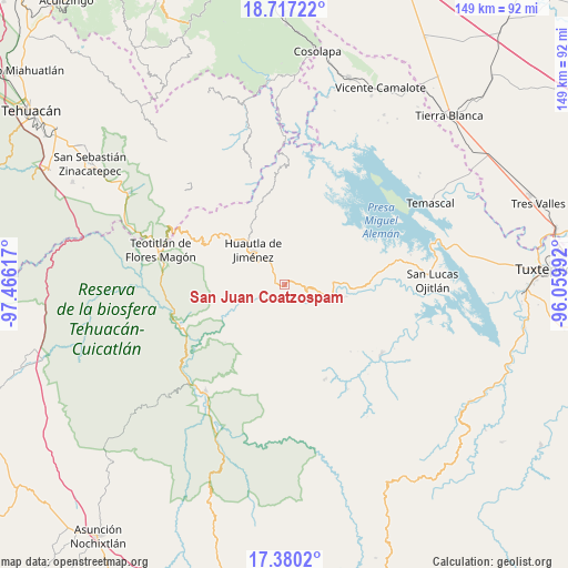
San Juan Coatzospam GPS coordinates[2]
18° 2' 59.928" North, 96° 45' 46.944" West
| Map corner | latitude | longitude |
|---|---|---|
| Upper-left | 18.71722°, | -97.46617° |
| Center: | 18.04998°, | -96.76304° |
| Lower-right: | 17.3802°, | -96.05992° |
| Map W x H: | 148.7×148.7 km | = 92.4×92.4mi |
| max Lat: | 32.7° ⇑78.1% North |
| San Juan Coatzospam: | 18.04998° |
| min Lat: | ⇓21.9% South 14.53588° |
| min Long | San Juan Coatzo | max Long |
| -117.105° | -96.76304° | -86.73105° |
| W 77.7%⇐ | ⇒22.3% E |
Elevation
Elevation of San Juan Coatzospam is 1871 m = 6138 ft, and this is 617.3 m = 2025 ft above average elevation for this country.
| Max E: |
3497 m = 11473 ft | 32.9% |
| San Juan Coatzospam | 1871 m 6138 ft | |
| Avg. | 1253.7 m = 4113 ft | |
Min E: |
-1 m = -3 ft | 67.1% |
See also: Mexico elevation on elevation.city.
Geographical zone
San Juan Coatzospam is located in North Torrid zone (between Equator and Tropic of Cancer). Distance of this Northern Tropic circle is 598.9 km =372.1 mi to North.| Distance of | km | miles | from San Juan Coatzospam |
|---|---|---|---|
| North Pole | 8000.1 | 4971 | to North |
| Arctic Circle | 5394.2 | 3351.8 | to North |
| Tropic Cancer | 598.9 | 372.1 | to North |
| Equator | 2007 | 1247.1 | to South |


Nearby cities:
15 places around San Juan Coatzospam: (largest is in red/bold)
• Aguacatitla
10.3 km =6.4 mi,  260°
260°
• Chiquihuitlán de Benito Juárez
6.3 km =3.9 mi,  162°
162°
• El Camarón
4.4 km =2.7 mi,  291°
291°
• Huautepec
6.7 km =4.2 mi,  328°
328°
• La Soledad Piedra Ancha
6.3 km =3.9 mi,  95°
95°
• Llano de Agua
8 km =5 mi,  321°
321°
• Río Santiago
8.1 km =5 mi,  1°
1°
• San Andrés Hidalgo
10.7 km =6.6 mi, 334°
• San Bartolomé Ayautla
9.9 km =6.2 mi, 101°
• San Isidro
0.7 km =0.4 mi,  146°
146°
• San Pedro Teutila
10 km =6.2 mi,  143°
143°
• Santa Ana Cuauhtémoc
8 km =5 mi,  204°
204°
• Santa Catarina Buenavista
5.3 km =3.3 mi,  304°
304°
• Santa María la Asunción
8.7 km =5.4 mi, 317°
• Xochitonalco
10.3 km =6.4 mi, 298°
Sources, notices
• [Note1] Compared only with cities in Mexico existing in our database
• [Src1] Map data: © OpenStreetMap contributors (CC-BY-SA)
• [Src2] Other city data from geonames.org with taken over terms of usage.
• [Src3] Geographical zone / Annual Mean Temperature by Robert A. Rohde @ Wikipedia
