El Camarón geodata
El Camarón (Oaxaca) is a populated place; located in Mexico in America/Mexico_City (GMT-6) time zone. With population of 779 people, there are 11211 cities with bigger population in this country. Compared to other cities in Mexico, 78% of cities are located further ↑North; 77.2% of cities are located further ←West and 54.5% of cities have higher elevation than El Camarón. Note1


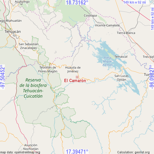
El Camarón GPS coordinates[2]
18° 3' 51.984" North, 96° 48' 5.004" West
| Map corner | latitude | longitude |
|---|---|---|
| Upper-left | 18.73162°, | -97.50452° |
| Center: | 18.06444°, | -96.80139° |
| Lower-right: | 17.39471°, | -96.09827° |
| Map W x H: | 148.7×148.7 km | = 92.4×92.4mi |
| max Lat: | 32.7° ⇑78% North |
| El Camarón: | 18.06444° |
| min Lat: | ⇓22% South 14.53588° |
| min Long | El Camarón | max Long |
| -117.105° | -96.80139° | -86.73105° |
| W 77.2%⇐ | ⇒22.8% E |
Elevation
Elevation of El Camarón is 1219 m = 3999 ft, and this is 34.7 m = 114 ft below average elevation for this country.
| Max E: |
3497 m = 11473 ft | 54.5% |
| Avg. | 1253.7 m = 4113 ft | |
| El Camarón | 1219 m = 3999 ft | |
Min E: |
-1 m = -3 ft | 45.5% |
See also: Mexico elevation on elevation.city.
Geographical zone
El Camarón is located in North Torrid zone (between Equator and Tropic of Cancer). Distance of this Northern Tropic circle is 597.3 km =371.1 mi to North.| Distance of | km | miles | from El Camarón |
|---|---|---|---|
| North Pole | 7998.5 | 4970 | to North |
| Arctic Circle | 5392.6 | 3350.8 | to North |
| Tropic Cancer | 597.3 | 371.1 | to North |
| Equator | 2008.6 | 1248.1 | to South |


Nearby cities:
15 places around El Camarón: (largest is in red/bold)
• Aguacatitla
6.9 km =4.3 mi,  241°
241°
• El Carrizal
7.4 km =4.6 mi,  306°
306°
• Huautepec
4.1 km =2.5 mi,  8°
8°
• Huautla de Jiménez
8.5 km =5.3 mi,  330°
330°
• Llano de Agua
4.7 km =2.9 mi,  347°
347°
• Loma Chapultepec
7.3 km =4.5 mi, 326°
• Loma Chilar
9 km =5.6 mi,  342°
342°
• Río Santiago
7.8 km =4.8 mi,  33°
33°
• San Andrés Hidalgo
8.1 km =5 mi,  356°
356°
• San Isidro
4.9 km =3 mi,  116°
116°
• San Juan Coatzospam
4.4 km =2.7 mi,  111°
111°
• Santa Ana Cuauhtémoc
8.9 km =5.5 mi,  175°
175°
• Santa Catarina Buenavista
1.4 km =0.9 mi, 347°
• Santa María la Asunción
5.1 km =3.2 mi, 338°
• Xochitonalco
6 km =3.7 mi,  303°
303°
Sources, notices
• [Note1] Compared only with cities in Mexico existing in our database
• [Src1] Map data: © OpenStreetMap contributors (CC-BY-SA)
• [Src2] Other city data from geonames.org with taken over terms of usage.
• [Src3] Geographical zone / Annual Mean Temperature by Robert A. Rohde @ Wikipedia
