San Pedro Tapanatepec geodata
San Pedro Tapanatepec (Oaxaca) is a populated place; located in Mexico in America/Mexico_City (GMT-6) time zone. With population of 7,441 people, there are 1250 cities with bigger population in this country. Compared to other cities in Mexico, 95.2% of cities are located further ↑North; 85.7% of cities are located further ←West and 83.4% of cities have higher elevation than San Pedro Tapanatepec. Note1


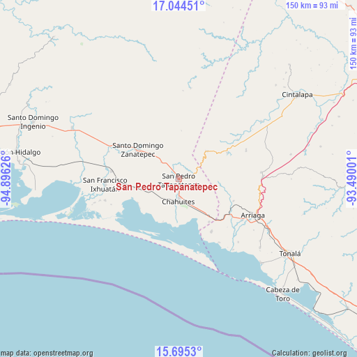
San Pedro Tapanatepec GPS coordinates[2]
16° 22' 15.852" North, 94° 11' 35.268" West
| Map corner | latitude | longitude |
|---|---|---|
| Upper-left | 17.04451°, | -94.89626° |
| Center: | 16.37107°, | -94.19313° |
| Lower-right: | 15.6953°, | -93.49001° |
| Map W x H: | 150×150 km | = 93.2×93.2mi |
| max Lat: | 32.7° ⇑95.2% North |
| San Pedro Tapanatepec: | 16.37107° |
| min Lat: | ⇓4.8% South 14.53588° |
| min Long | San Pedro Tapan | max Long |
| -117.105° | -94.19313° | -86.73105° |
| W 85.7%⇐ | ⇒14.3% E |
Elevation
Elevation of San Pedro Tapanatepec is 57 m = 187 ft, and this is 1196.7 m = 3926 ft below average elevation for this country.
| Max E: |
3497 m = 11473 ft | 83.4% |
| Avg. | 1253.7 m = 4113 ft | |
| San Pedro Tapanatepec | 57 m = 187 ft | |
Min E: |
-1 m = -3 ft | 16.6% |
See also: Mexico elevation on elevation.city.
Geographical zone
San Pedro Tapanatepec is located in North Torrid zone (between Equator and Tropic of Cancer). Distance of this Northern Tropic circle is 785.6 km =488.1 mi to North.| Distance of | km | miles | from San Pedro Tapanatepec |
|---|---|---|---|
| North Pole | 8186.8 | 5087 | to North |
| Arctic Circle | 5580.9 | 3467.8 | to North |
| Tropic Cancer | 785.6 | 488.1 | to North |
| Equator | 1820.3 | 1131.1 | to South |


Nearby cities:
15 places around San Pedro Tapanatepec: (largest is in red/bold)
• Chahuite
8 km =5 mi,  172°
172°
• Chahuites
9.2 km =5.7 mi,  181°
181°
• El Espinal
9.5 km =5.9 mi,  91°
91°
• Emiliano Zapata
25.9 km =16.1 mi,  148°
148°
• General Pascual Fentes
10.3 km =6.4 mi,  313°
313°
• La Gloria
27.1 km =16.8 mi,  159°
159°
• Los Corazones
21.9 km =13.6 mi,  144°
144°
• Lázaro Cárdenas
24.8 km =15.4 mi,  111°
111°
• Nueva Tenochtitlán (Rizo de Oro)
16.8 km =10.4 mi,  45°
45°
• Pesquería Rancho Salinas
19.6 km =12.2 mi,  200°
200°
• Reforma de Pineda
28.4 km =17.6 mi,  276°
276°
• Rincón de Juárez
20 km =12.4 mi,  239°
239°
• Rosendo Salazar
23.1 km =14.4 mi,  62°
62°
• Santo Domingo Zanatepec
20.6 km =12.8 mi, 307°
• Yerba Santa
17.4 km =10.8 mi,  262°
262°
Sources, notices
• [Note1] Compared only with cities in Mexico existing in our database
• [Src1] Map data: © OpenStreetMap contributors (CC-BY-SA)
• [Src2] Other city data from geonames.org with taken over terms of usage.
• [Src3] Geographical zone / Annual Mean Temperature by Robert A. Rohde @ Wikipedia
