San Miguel geodata
San Miguel (Querétaro) is a populated place; located in Mexico in America/Mexico_City (GMT-6) time zone. With population of 736 people, there are 11874 cities with bigger population in this country. Compared to other cities in Mexico, 74.3% of cities are located further ↓South; 63.5% of cities are located further →East and 56.7% of cities have lower elevation than San Miguel. Note1


San Miguel GPS coordinates[2]
20° 52' 6.852" North, 99° 57' 41.796" West
| Map corner | latitude | longitude |
|---|---|---|
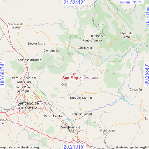
| Upper-left | 21.52412°, | -100.66474° |
| Center: | 20.86857°, | -99.96161° |
| Lower-right: | 20.21015°, | -99.25849° |
| Map W x H: | 146.1×146.1 km | = 90.8×90.8mi |
| max Lat: | 32.7° ⇑25.7% North |
| San Miguel: | 20.86857° |
| min Lat: | ⇓74.3% South 14.53588° |
| min Long | San Miguel | max Long |
| -117.105° | -99.96161° | -86.73105° |
| W 36.5%⇐ | ⇒63.5% E |
Elevation
Elevation of San Miguel is 1644 m = 5394 ft, and this is 390.3 m = 1281 ft above average elevation for this country.
| Max E: |
3497 m = 11473 ft | 43.3% |
| San Miguel | 1644 m 5394 ft | |
| Avg. | 1253.7 m = 4113 ft | |
Min E: |
-1 m = -3 ft | 56.7% |
See also: Mexico elevation on elevation.city.
Geographical zone
San Miguel is located in North Torrid zone (between Equator and Tropic of Cancer). Distance of this Northern Tropic circle is 285.6 km =177.5 mi to North.| Distance of | km | miles | from San Miguel |
|---|---|---|---|
| North Pole | 7686.7 | 4776.3 | to North |
| Arctic Circle | 5080.8 | 3157.1 | to North |
| Tropic Cancer | 285.6 | 177.5 | to North |
| Equator | 2320.4 | 1441.8 | to South |


Nearby cities:
15 places around San Miguel: (largest is in red/bold)
• Barrio de Casas Viejas
6.7 km =4.2 mi,  40°
40°
• Barrio de García
0.7 km =0.4 mi,  272°
272°
• Bomintzá
9.1 km =5.7 mi,  335°
335°
• Casa Blanca
7 km =4.3 mi,  354°
354°
• Diezmeros
1.3 km =0.8 mi,  53°
53°
• El Cerrito Parado
6.2 km =3.9 mi,  0°
0°
• El Poleo
9.1 km =5.7 mi, 268°
• Gudiños
6 km =3.7 mi,  284°
284°
• Horno de Cal
5.6 km =3.5 mi, 52°
• Los González
7.6 km =4.7 mi, 353°
• Mesa de Ramírez
7.4 km =4.6 mi, 335°
• Panales
3.7 km =2.3 mi, 283°
• Sabino de San Ambrosio
5.6 km =3.5 mi, 351°
• San Pablo Tolimán
6.5 km =4 mi,  101°
101°
• Tolimán
5.5 km =3.4 mi, 36°
Sources, notices
• [Note1] Compared only with cities in Mexico existing in our database
• [Src1] Map data: © OpenStreetMap contributors (CC-BY-SA)
• [Src2] Other city data from geonames.org with taken over terms of usage.
• [Src3] Geographical zone / Annual Mean Temperature by Robert A. Rohde @ Wikipedia
