El Cerrito Parado geodata
El Cerrito Parado (Querétaro) is a populated place; located in Mexico in America/Mexico_City (GMT-6) time zone. With population of 537 people, there are 15796 cities with bigger population in this country. Compared to other cities in Mexico, 75.3% of cities are located further ↓South; 63.5% of cities are located further →East and 57% of cities have lower elevation than El Cerrito Parado. Note1


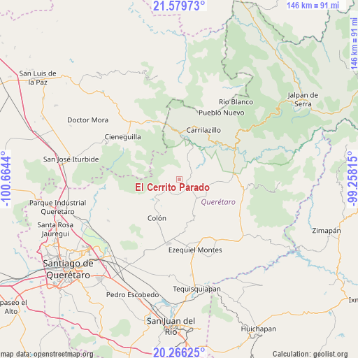
El Cerrito Parado GPS coordinates[2]
20° 55' 27.948" North, 99° 57' 40.572" West
| Map corner | latitude | longitude |
|---|---|---|
| Upper-left | 21.57973°, | -100.6644° |
| Center: | 20.92443°, | -99.96127° |
| Lower-right: | 20.26625°, | -99.25815° |
| Map W x H: | 146×146 km | = 90.7×90.7mi |
| max Lat: | 32.7° ⇑24.7% North |
| El Cerrito Parado: | 20.92443° |
| min Lat: | ⇓75.3% South 14.53588° |
| min Long | El Cerrito Para | max Long |
| -117.105° | -99.96127° | -86.73105° |
| W 36.5%⇐ | ⇒63.5% E |
Elevation
Elevation of El Cerrito Parado is 1659 m = 5443 ft, and this is 405.3 m = 1330 ft above average elevation for this country.
| Max E: |
3497 m = 11473 ft | 43% |
| El Cerrito Parado | 1659 m 5443 ft | |
| Avg. | 1253.7 m = 4113 ft | |
Min E: |
-1 m = -3 ft | 57% |
See also: Mexico elevation on elevation.city.
Geographical zone
El Cerrito Parado is located in North Torrid zone (between Equator and Tropic of Cancer). Distance of this Northern Tropic circle is 279.3 km =173.5 mi to North.| Distance of | km | miles | from El Cerrito Parado |
|---|---|---|---|
| North Pole | 7680.5 | 4772.4 | to North |
| Arctic Circle | 5074.6 | 3153.2 | to North |
| Tropic Cancer | 279.3 | 173.5 | to North |
| Equator | 2326.6 | 1445.7 | to South |


Nearby cities:
15 places around El Cerrito Parado: (largest is in red/bold)
• Barrio de Casas Viejas
4.5 km =2.8 mi,  104°
104°
• Barrio de García
6.2 km =3.9 mi,  187°
187°
• Bomintzá
4.3 km =2.7 mi,  297°
297°
• Casa Blanca
1.1 km =0.7 mi,  316°
316°
• Diezmeros
5.6 km =3.5 mi,  169°
169°
• El Poleo
11.2 km =7 mi,  235°
235°
• Gudiños
7.5 km =4.7 mi,  231°
231°
• Horno de Cal
5.2 km =3.2 mi,  122°
122°
• Los González
1.6 km =1 mi,  328°
328°
• Mesa de Ramírez
3.1 km =1.9 mi,  279°
279°
• Panales
6.5 km =4 mi,  214°
214°
• Sabino de San Ambrosio
1.1 km =0.7 mi, 234°
• San Miguel
6.2 km =3.9 mi,  180°
180°
• San Pablo Tolimán
9.8 km =6.1 mi,  139°
139°
• Tolimán
3.7 km =2.3 mi, 118°
Sources, notices
• [Note1] Compared only with cities in Mexico existing in our database
• [Src1] Map data: © OpenStreetMap contributors (CC-BY-SA)
• [Src2] Other city data from geonames.org with taken over terms of usage.
• [Src3] Geographical zone / Annual Mean Temperature by Robert A. Rohde @ Wikipedia
