San Carlos Yautepec geodata
San Carlos Yautepec (Oaxaca) is a seat of a second-order administrative division; located in Mexico in America/Mexico_City (GMT-6) time zone. With population of 880 people, there are 9928 cities with bigger population in this country. Compared to other cities in Mexico, 94.3% of cities are located further ↑North; 81.8% of cities are located further ←West and 61.9% of cities have higher elevation than San Carlos Yautepec. Note1


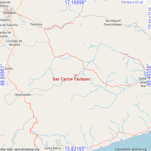
San Carlos Yautepec GPS coordinates[2]
16° 29' 49.164" North, 96° 6' 23.328" West
| Map corner | latitude | longitude |
|---|---|---|
| Upper-left | 17.16998°, | -96.80961° |
| Center: | 16.49699°, | -96.10648° |
| Lower-right: | 15.82165°, | -95.40336° |
| Map W x H: | 149.9×149.9 km | = 93.1×93.1mi |
| max Lat: | 32.7° ⇑94.3% North |
| San Carlos Yautepec: | 16.49699° |
| min Lat: | ⇓5.7% South 14.53588° |
| min Long | San Carlos Yaut | max Long |
| -117.105° | -96.10648° | -86.73105° |
| W 81.8%⇐ | ⇒18.2% E |
Elevation
Elevation of San Carlos Yautepec is 887 m = 2910 ft, and this is 366.7 m = 1203 ft below average elevation for this country.
| Max E: |
3497 m = 11473 ft | 61.9% |
| Avg. | 1253.7 m = 4113 ft | |
| San Carlos Yautepec | 887 m = 2910 ft | |
Min E: |
-1 m = -3 ft | 38.1% |
See also: Mexico elevation on elevation.city.
Geographical zone
San Carlos Yautepec is located in North Torrid zone (between Equator and Tropic of Cancer). Distance of this Northern Tropic circle is 771.6 km =479.4 mi to North.| Distance of | km | miles | from San Carlos Yautepec |
|---|---|---|---|
| North Pole | 8172.8 | 5078.3 | to North |
| Arctic Circle | 5566.9 | 3459.1 | to North |
| Tropic Cancer | 771.6 | 479.4 | to North |
| Equator | 1834.3 | 1139.8 | to South |


Nearby cities:
15 places around San Carlos Yautepec: (largest is in red/bold)
• El Camarón
10.7 km =6.6 mi,  50°
50°
• La Mancornada
18.9 km =11.7 mi,  29°
29°
• Las Ánimas
16.2 km =10.1 mi, 29°
• Nejapa de Madero
18.2 km =11.3 mi, 48°
• San Bartolo Yautepec
16 km =9.9 mi,  118°
118°
• San Francisco Guichina
2.7 km =1.7 mi,  178°
178°
• San Isidro Chihuiro
7.6 km =4.7 mi,  74°
74°
• San Pedro Leapi
18.3 km =11.4 mi,  187°
187°
• San Pedro Mártir Quiechapa
17.3 km =10.7 mi,  238°
238°
• Santa Catalina Quieri
25.9 km =16.1 mi,  221°
221°
• Santa Catalina Quierí
26.1 km =16.2 mi, 220°
• Santa María Quiegolani
25.1 km =15.6 mi,  166°
166°
• Santiago Lachivía
18.3 km =11.4 mi, 219°
• Santo Tomás Quieri
18.3 km =11.4 mi,  205°
205°
• Soledad Salinas
21.5 km =13.4 mi, 31°
Sources, notices
• [Note1] Compared only with cities in Mexico existing in our database
• [Src1] Map data: © OpenStreetMap contributors (CC-BY-SA)
• [Src2] Other city data from geonames.org with taken over terms of usage.
• [Src3] Geographical zone / Annual Mean Temperature by Robert A. Rohde @ Wikipedia
