Las Ánimas geodata
Las Ánimas (Oaxaca) is a populated place; located in Mexico in America/Mexico_City (GMT-6) time zone. With population of 674 people, there are 12893 cities with bigger population in this country. Compared to other cities in Mexico, 93.4% of cities are located further ↑North; 82.1% of cities are located further ←West and 65.2% of cities have higher elevation than Las Ánimas. Note1


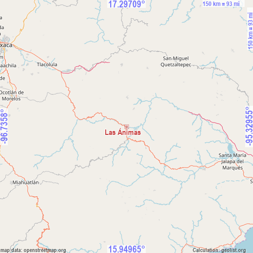
Las Ánimas GPS coordinates[2]
16° 37' 28.38" North, 96° 1' 57.612" West
| Map corner | latitude | longitude |
|---|---|---|
| Upper-left | 17.29709°, | -96.7358° |
| Center: | 16.62455°, | -96.03267° |
| Lower-right: | 15.94965°, | -95.32955° |
| Map W x H: | 149.8×149.8 km | = 93.1×93.1mi |
| max Lat: | 32.7° ⇑93.4% North |
| Las Ánimas: | 16.62455° |
| min Lat: | ⇓6.6% South 14.53588° |
| min Long | Las Ánimas | max Long |
| -117.105° | -96.03267° | -86.73105° |
| W 82.1%⇐ | ⇒17.9% E |
Elevation
Elevation of Las Ánimas is 676 m = 2218 ft, and this is 577.7 m = 1895 ft below average elevation for this country.
| Max E: |
3497 m = 11473 ft | 65.2% |
| Avg. | 1253.7 m = 4113 ft | |
| Las Ánimas | 676 m = 2218 ft | |
Min E: |
-1 m = -3 ft | 34.8% |
See also: Mexico elevation on elevation.city.
Geographical zone
Las Ánimas is located in North Torrid zone (between Equator and Tropic of Cancer). Distance of this Northern Tropic circle is 757.4 km =470.6 mi to North.| Distance of | km | miles | from Las Ánimas |
|---|---|---|---|
| North Pole | 8158.6 | 5069.5 | to North |
| Arctic Circle | 5552.7 | 3450.3 | to North |
| Tropic Cancer | 757.4 | 470.6 | to North |
| Equator | 1848.5 | 1148.6 | to South |


Nearby cities:
15 places around Las Ánimas: (largest is in red/bold)
• Asunción Acatlán
31.4 km =19.5 mi,  16°
16°
• El Camarón
7.5 km =4.7 mi,  176°
176°
• La Mancornada
2.7 km =1.7 mi,  29°
29°
• Nejapa de Madero
6.1 km =3.8 mi,  109°
109°
• San Bartolo Yautepec
22.6 km =14 mi,  164°
164°
• San Carlos Yautepec
16.2 km =10.1 mi,  209°
209°
• San Francisco Guichina
18.6 km =11.6 mi,  204°
204°
• San Isidro Chihuiro
12.2 km =7.6 mi, 182°
• San Juan del Río
31.9 km =19.8 mi,  334°
334°
• San Pablo Lachiriega
24.2 km =15 mi,  5°
5°
• San Pedro Quiatoni
17.6 km =10.9 mi,  0°
0°
• San Pedro Totolápam
29.7 km =18.5 mi,  279°
279°
• Santa Ana Tavela
13.5 km =8.4 mi,  75°
75°
• Santo Tomás de Arriba
27.5 km =17.1 mi,  308°
308°
• Soledad Salinas
5.3 km =3.3 mi,  37°
37°
Sources, notices
• [Note1] Compared only with cities in Mexico existing in our database
• [Src1] Map data: © OpenStreetMap contributors (CC-BY-SA)
• [Src2] Other city data from geonames.org with taken over terms of usage.
• [Src3] Geographical zone / Annual Mean Temperature by Robert A. Rohde @ Wikipedia
