Santiago Lachivía geodata
Santiago Lachivía (Oaxaca) is a populated place; located in Mexico in America/Mexico_City (GMT-6) time zone. With population of 940 people, there are 9266 cities with bigger population in this country. Compared to other cities in Mexico, 95.2% of cities are located further ↑North; 81.3% of cities are located further ←West and 76.6% of cities have lower elevation than Santiago Lachivía. Note1


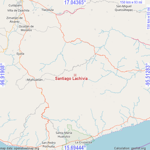
Santiago Lachivía GPS coordinates[2]
16° 22' 12.756" North, 96° 12' 57.42" West
| Map corner | latitude | longitude |
|---|---|---|
| Upper-left | 17.04365°, | -96.91908° |
| Center: | 16.37021°, | -96.21595° |
| Lower-right: | 15.69444°, | -95.51283° |
| Map W x H: | 150×150 km | = 93.2×93.2mi |
| max Lat: | 32.7° ⇑95.2% North |
| Santiago Lachivía: | 16.37021° |
| min Lat: | ⇓4.8% South 14.53588° |
| min Long | Santiago Lachiv | max Long |
| -117.105° | -96.21595° | -86.73105° |
| W 81.3%⇐ | ⇒18.7% E |
Elevation
Elevation of Santiago Lachivía is 2059 m = 6755 ft, and this is 805.3 m = 2642 ft above average elevation for this country.
| Max E: |
3497 m = 11473 ft | 23.4% |
| Santiago Lachivía | 2059 m 6755 ft | |
| Avg. | 1253.7 m = 4113 ft | |
Min E: |
-1 m = -3 ft | 76.6% |
See also: Mexico elevation on elevation.city.
Geographical zone
Santiago Lachivía is located in North Torrid zone (between Equator and Tropic of Cancer). Distance of this Northern Tropic circle is 785.7 km =488.2 mi to North.| Distance of | km | miles | from Santiago Lachivía |
|---|---|---|---|
| North Pole | 8186.9 | 5087.1 | to North |
| Arctic Circle | 5581 | 3467.9 | to North |
| Tropic Cancer | 785.7 | 488.2 | to North |
| Equator | 1820.2 | 1131 | to South |


Nearby cities:
15 places around Santiago Lachivía: (largest is in red/bold)
• Bramadero
16.2 km =10.1 mi,  276°
276°
• El Costoche
19 km =11.8 mi, 280°
• Nizagoche
14.8 km =9.2 mi,  291°
291°
• San Carlos Yautepec
18.3 km =11.4 mi,  39°
39°
• San Francisco Guichina
16.4 km =10.2 mi,  45°
45°
• San Francisco Logueche
17.3 km =10.7 mi,  263°
263°
• San José Lachiguirí
12.8 km =8 mi,  273°
273°
• San Juan Mixtepec
13.7 km =8.5 mi,  221°
221°
• San Pedro Leapi
10.2 km =6.3 mi,  113°
113°
• San Pedro Mixtepec
13.2 km =8.2 mi,  213°
213°
• San Pedro Mártir Quiechapa
5.9 km =3.7 mi,  328°
328°
• Santa Catalina Quieri
7.6 km =4.7 mi, 224°
• Santa Catalina Quierí
7.8 km =4.8 mi, 224°
• Santa Catarina Quioquitani
9.7 km =6 mi,  230°
230°
• Santo Tomás Quieri
4.4 km =2.7 mi,  123°
123°
Sources, notices
• [Note1] Compared only with cities in Mexico existing in our database
• [Src1] Map data: © OpenStreetMap contributors (CC-BY-SA)
• [Src2] Other city data from geonames.org with taken over terms of usage.
• [Src3] Geographical zone / Annual Mean Temperature by Robert A. Rohde @ Wikipedia
