Teontepec geodata
Teontepec (Puebla) is a populated place; located in Mexico in America/Mexico_City (GMT-6) time zone. With population of 5,593 people, there are 1667 cities with bigger population in this country. Compared to other cities in Mexico, 72.7% of cities are located further ↑North; 69.2% of cities are located further ←West and 64.6% of cities have lower elevation than Teontepec. Note1


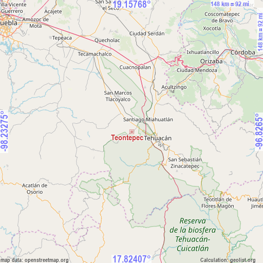
Teontepec GPS coordinates[2]
18° 29' 31.812" North, 97° 31' 46.632" West
| Map corner | latitude | longitude |
|---|---|---|
| Upper-left | 19.15768°, | -98.23275° |
| Center: | 18.49217°, | -97.52962° |
| Lower-right: | 17.82407°, | -96.8265° |
| Map W x H: | 148.3×148.3 km | = 92.1×92.1mi |
| max Lat: | 32.7° ⇑72.7% North |
| Teontepec: | 18.49217° |
| min Lat: | ⇓27.3% South 14.53588° |
| min Long | Teontepec | max Long |
| -117.105° | -97.52962° | -86.73105° |
| W 69.2%⇐ | ⇒30.8% E |
Elevation
Elevation of Teontepec is 1817 m = 5961 ft, and this is 563.3 m = 1848 ft above average elevation for this country.
| Max E: |
3497 m = 11473 ft | 35.4% |
| Teontepec | 1817 m 5961 ft | |
| Avg. | 1253.7 m = 4113 ft | |
Min E: |
-1 m = -3 ft | 64.6% |
See also: Mexico elevation on elevation.city.
Geographical zone
Teontepec is located in North Torrid zone (between Equator and Tropic of Cancer). Distance of this Northern Tropic circle is 549.8 km =341.6 mi to North.| Distance of | km | miles | from Teontepec |
|---|---|---|---|
| North Pole | 7950.9 | 4940.5 | to North |
| Arctic Circle | 5345 | 3321.2 | to North |
| Tropic Cancer | 549.8 | 341.6 | to North |
| Equator | 2056.1 | 1277.6 | to South |


Nearby cities:
15 places around Teontepec: (largest is in red/bold)
• Benito Juárez
9.1 km =5.7 mi,  31°
31°
• Francisco Ignacio Madero
6.9 km =4.3 mi,  89°
89°
• La Calavera
12.7 km =7.9 mi,  65°
65°
• Magdalena Cuayucatepec
8 km =5 mi,  36°
36°
• Miahuatlán
11.5 km =7.1 mi,  55°
55°
• Pazoltepec
15.6 km =9.7 mi,  342°
342°
• San Andrés Cacaloapan
11.8 km =7.3 mi,  329°
329°
• San Isidro Vista Hermosa
13.7 km =8.5 mi,  83°
83°
• San José Monte Chiquito
9.7 km =6 mi, 87°
• Tehuacán
14.3 km =8.9 mi,  102°
102°
• Teloxtoc
13.6 km =8.5 mi,  203°
203°
• Temalacayuca
12.8 km =8 mi,  346°
346°
• Tepanco
7.9 km =4.9 mi, 335°
• Texcala
13.8 km =8.6 mi,  139°
139°
• Villa Alegría
12.2 km =7.6 mi, 70°
Sources, notices
• [Note1] Compared only with cities in Mexico existing in our database
• [Src1] Map data: © OpenStreetMap contributors (CC-BY-SA)
• [Src2] Other city data from geonames.org with taken over terms of usage.
• [Src3] Geographical zone / Annual Mean Temperature by Robert A. Rohde @ Wikipedia
