Once de Abril geodata
Once de Abril (Chiapas) is a populated place; located in Mexico in America/Mexico_City (GMT-6) time zone. With population of 1,209 people, there are 7199 cities with bigger population in this country. Compared to other cities in Mexico, 99.3% of cities are located further ↑North; 94.6% of cities are located further ←West and 62.9% of cities have higher elevation than Once de Abril. Note1


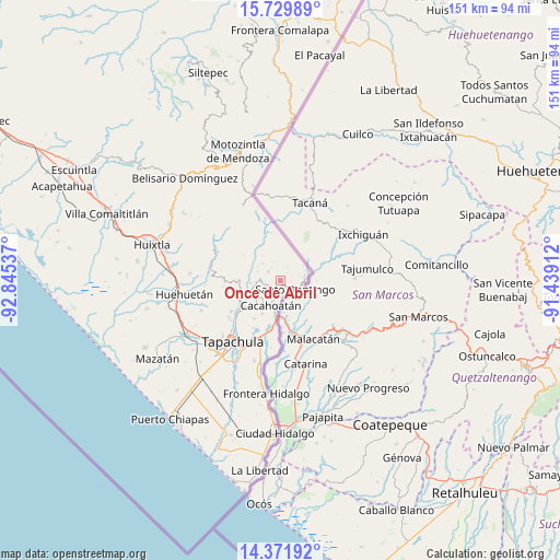
Once de Abril GPS coordinates[2]
15° 3' 7.164" North, 92° 8' 32.064" West
| Map corner | latitude | longitude |
|---|---|---|
| Upper-left | 15.72989°, | -92.84537° |
| Center: | 15.05199°, | -92.14224° |
| Lower-right: | 14.37192°, | -91.43912° |
| Map W x H: | 151×151 km | = 93.8×93.8mi |
| max Lat: | 32.7° ⇑99.3% North |
| Once de Abril: | 15.05199° |
| min Lat: | ⇓0.7% South 14.53588° |
| min Long | Once de Abril | max Long |
| -117.105° | -92.14224° | -86.73105° |
| W 94.6%⇐ | ⇒5.4% E |
Elevation
Elevation of Once de Abril is 825 m = 2707 ft, and this is 428.7 m = 1406 ft below average elevation for this country.
| Max E: |
3497 m = 11473 ft | 62.9% |
| Avg. | 1253.7 m = 4113 ft | |
| Once de Abril | 825 m = 2707 ft | |
Min E: |
-1 m = -3 ft | 37.1% |
See also: Mexico elevation on elevation.city.
Geographical zone
Once de Abril is located in North Torrid zone (between Equator and Tropic of Cancer). Distance of this Northern Tropic circle is 932.3 km =579.3 mi to North.| Distance of | km | miles | from Once de Abril |
|---|---|---|---|
| North Pole | 8333.4 | 5178.1 | to North |
| Arctic Circle | 5727.5 | 3558.9 | to North |
| Tropic Cancer | 932.3 | 579.3 | to North |
| Equator | 1673.6 | 1039.9 | to South |


Nearby cities:
15 places around Once de Abril: (largest is in red/bold)
• Ahuacatlán
4.3 km =2.7 mi,  252°
252°
• Alpujarras
4 km =2.5 mi,  308°
308°
• Bellavista
2.8 km =1.7 mi,  343°
343°
• Benito Juárez
5.3 km =3.3 mi,  273°
273°
• Dos de Mayo
3.4 km =2.1 mi,  193°
193°
• El Carmen
3.3 km =2.1 mi,  223°
223°
• El Platanar
4.1 km =2.5 mi,  328°
328°
• El Águila
6.5 km =4 mi, 314°
• Faja de Oro
2.6 km =1.6 mi,  214°
214°
• Guatimoc
1.3 km =0.8 mi,  243°
243°
• Mixcum
2.9 km =1.8 mi,  176°
176°
• Rosario Ixtal
5.2 km =3.2 mi, 194°
• San Jerónimo
1.3 km =0.8 mi,  156°
156°
• Santo Domingo
4.8 km =3 mi,  119°
119°
• Trinidad
3.1 km =1.9 mi, 121°
Sources, notices
• [Note1] Compared only with cities in Mexico existing in our database
• [Src1] Map data: © OpenStreetMap contributors (CC-BY-SA)
• [Src2] Other city data from geonames.org with taken over terms of usage.
• [Src3] Geographical zone / Annual Mean Temperature by Robert A. Rohde @ Wikipedia
