El Platanar geodata
El Platanar (Chiapas) is a populated place; located in Mexico in America/Mexico_City (GMT-6) time zone. With population of 747 people, there are 11723 cities with bigger population in this country. Compared to other cities in Mexico, 99.3% of cities are located further ↑North; 94.4% of cities are located further ←West and 53.5% of cities have higher elevation than El Platanar. Note1


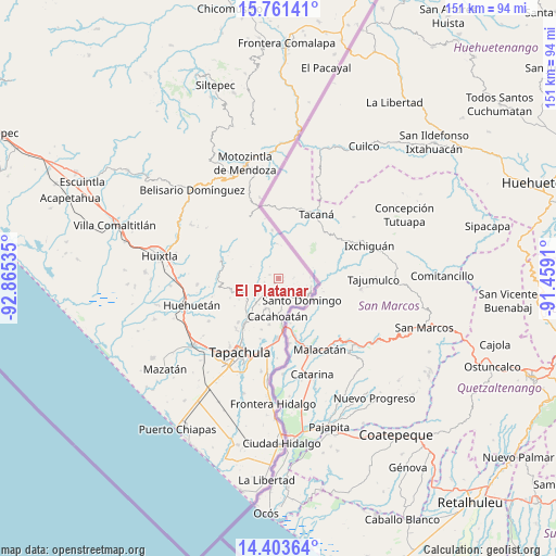
El Platanar GPS coordinates[2]
15° 5' 0.996" North, 92° 9' 43.992" West
| Map corner | latitude | longitude |
|---|---|---|
| Upper-left | 15.76141°, | -92.86535° |
| Center: | 15.08361°, | -92.16222° |
| Lower-right: | 14.40364°, | -91.4591° |
| Map W x H: | 151×151 km | = 93.8×93.8mi |
| max Lat: | 32.7° ⇑99.3% North |
| El Platanar: | 15.08361° |
| min Lat: | ⇓0.7% South 14.53588° |
| min Long | El Platanar | max Long |
| -117.105° | -92.16222° | -86.73105° |
| W 94.4%⇐ | ⇒5.6% E |
Elevation
Elevation of El Platanar is 1268 m = 4160 ft, and this is 14.3 m = 47 ft above average elevation for this country.
| Max E: |
3497 m = 11473 ft | 53.5% |
| El Platanar | 1268 m 4160 ft | |
| Avg. | 1253.7 m = 4113 ft | |
Min E: |
-1 m = -3 ft | 46.5% |
See also: Mexico elevation on elevation.city.
Geographical zone
El Platanar is located in North Torrid zone (between Equator and Tropic of Cancer). Distance of this Northern Tropic circle is 928.8 km =577.1 mi to North.| Distance of | km | miles | from El Platanar |
|---|---|---|---|
| North Pole | 8329.9 | 5176 | to North |
| Arctic Circle | 5724 | 3556.7 | to North |
| Tropic Cancer | 928.8 | 577.1 | to North |
| Equator | 1677.1 | 1042.1 | to South |


Nearby cities:
15 places around El Platanar: (largest is in red/bold)
• Agustín de Iturbide
4 km =2.5 mi,  256°
256°
• Ahuacatlán
5.2 km =3.2 mi,  202°
202°
• Alpujarras
1.4 km =0.9 mi,  222°
222°
• Bellavista
1.6 km =1 mi,  121°
121°
• Benito Juárez
4.4 km =2.7 mi, 224°
• El Carmen
5.9 km =3.7 mi,  181°
181°
• El Manacal
6.4 km =4 mi,  289°
289°
• El Progreso
3.8 km =2.4 mi,  275°
275°
• El Águila
2.7 km =1.7 mi, 293°
• Faja de Oro
5.7 km =3.5 mi,  173°
173°
• Guatimoc
4.2 km =2.6 mi, 166°
• Mixcum
6.8 km =4.2 mi,  160°
160°
• Nuevo Chespal
6.2 km =3.9 mi,  303°
303°
• Once de Abril
4.1 km =2.5 mi,  148°
148°
• San Jerónimo
5.4 km =3.4 mi, 150°
Sources, notices
• [Note1] Compared only with cities in Mexico existing in our database
• [Src1] Map data: © OpenStreetMap contributors (CC-BY-SA)
• [Src2] Other city data from geonames.org with taken over terms of usage.
• [Src3] Geographical zone / Annual Mean Temperature by Robert A. Rohde @ Wikipedia
