Huichihuayan geodata
Huichihuayan (San Luis Potosí) is a populated place; located in Mexico in America/Mexico_City (GMT-6) time zone. With population of 2,073 people, there are 4207 cities with bigger population in this country. Compared to other cities in Mexico, 81.3% of cities are located further ↓South; 50.7% of cities are located further ←West and 79.7% of cities have higher elevation than Huichihuayan. Note1


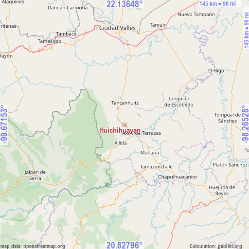
Huichihuayan GPS coordinates[2]
21° 29' 1.284" North, 98° 58' 6.24" West
| Map corner | latitude | longitude |
|---|---|---|
| Upper-left | 22.13648°, | -99.67153° |
| Center: | 21.48369°, | -98.9684° |
| Lower-right: | 20.82796°, | -98.26528° |
| Map W x H: | 145.5×145.5 km | = 90.4×90.4mi |
| max Lat: | 32.7° ⇑18.7% North |
| Huichihuayan: | 21.48369° |
| min Lat: | ⇓81.3% South 14.53588° |
| min Long | Huichihuayan | max Long |
| -117.105° | -98.9684° | -86.73105° |
| W 50.7%⇐ | ⇒49.3% E |
Elevation
Elevation of Huichihuayan is 100 m = 328 ft, and this is 1153.7 m = 3785 ft below average elevation for this country.
| Max E: |
3497 m = 11473 ft | 79.7% |
| Avg. | 1253.7 m = 4113 ft | |
| Huichihuayan | 100 m = 328 ft | |
Min E: |
-1 m = -3 ft | 20.3% |
See also: Mexico elevation on elevation.city.
Geographical zone
Huichihuayan is located in North Torrid zone (between Equator and Tropic of Cancer). Distance of this Northern Tropic circle is 217.2 km =135 mi to North.| Distance of | km | miles | from Huichihuayan |
|---|---|---|---|
| North Pole | 7618.3 | 4733.8 | to North |
| Arctic Circle | 5012.4 | 3114.6 | to North |
| Tropic Cancer | 217.2 | 135 | to North |
| Equator | 2388.8 | 1484.3 | to South |


Nearby cities:
15 places around Huichihuayan: (largest is in red/bold)
• Chimalaco
3.9 km =2.4 mi,  130°
130°
• El Cañón
6.3 km =3.9 mi,  215°
215°
• Jilim Tantocoy Tres
4.4 km =2.7 mi,  329°
329°
• La Escalera
5 km =3.1 mi,  311°
311°
• La Herradura
5 km =3.1 mi,  156°
156°
• La Pimienta
6.3 km =3.9 mi,  321°
321°
• Peña Blanca
6.2 km =3.9 mi,  192°
192°
• Rancho Nuevo
4.7 km =2.9 mi, 132°
• San Antonio Huitzquilico (Barrio Centro)
3.2 km =2 mi,  257°
257°
• San Pedro Huitzquilico
5.4 km =3.4 mi,  236°
236°
• Tampuchón
3.4 km =2.1 mi,  31°
31°
• Tanleab Uno
6.7 km =4.2 mi,  10°
10°
• Tantocoy Uno
5.8 km =3.6 mi,  335°
335°
• Tazaquil
3.1 km =1.9 mi,  74°
74°
• Tepotzuapa Primera Sección
4.5 km =2.8 mi,  95°
95°
Sources, notices
• [Note1] Compared only with cities in Mexico existing in our database
• [Src1] Map data: © OpenStreetMap contributors (CC-BY-SA)
• [Src2] Other city data from geonames.org with taken over terms of usage.
• [Src3] Geographical zone / Annual Mean Temperature by Robert A. Rohde @ Wikipedia
