Chimalaco geodata
Chimalaco (San Luis Potosí) is a populated place; located in Mexico in America/Mexico_City (GMT-6) time zone. With population of 714 people, there are 12202 cities with bigger population in this country. Compared to other cities in Mexico, 81.2% of cities are located further ↓South; 51.3% of cities are located further ←West and 79.3% of cities have higher elevation than Chimalaco. Note1


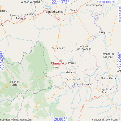
Chimalaco GPS coordinates[2]
21° 27' 38.988" North, 98° 56' 22.992" West
| Map corner | latitude | longitude |
|---|---|---|
| Upper-left | 22.11372°, | -99.64285° |
| Center: | 21.46083°, | -98.93972° |
| Lower-right: | 20.805°, | -98.2366° |
| Map W x H: | 145.5×145.5 km | = 90.4×90.4mi |
| max Lat: | 32.7° ⇑18.8% North |
| Chimalaco: | 21.46083° |
| min Lat: | ⇓81.2% South 14.53588° |
| min Long | Chimalaco | max Long |
| -117.105° | -98.93972° | -86.73105° |
| W 51.3%⇐ | ⇒48.7% E |
Elevation
Elevation of Chimalaco is 105 m = 344 ft, and this is 1148.7 m = 3769 ft below average elevation for this country.
| Max E: |
3497 m = 11473 ft | 79.3% |
| Avg. | 1253.7 m = 4113 ft | |
| Chimalaco | 105 m = 344 ft | |
Min E: |
-1 m = -3 ft | 20.7% |
See also: Mexico elevation on elevation.city.
Geographical zone
Chimalaco is located in North Torrid zone (between Equator and Tropic of Cancer). Distance of this Northern Tropic circle is 219.7 km =136.5 mi to North.| Distance of | km | miles | from Chimalaco |
|---|---|---|---|
| North Pole | 7620.8 | 4735.3 | to North |
| Arctic Circle | 5015 | 3116.2 | to North |
| Tropic Cancer | 219.7 | 136.5 | to North |
| Equator | 2386.2 | 1482.7 | to South |


Nearby cities:
15 places around Chimalaco: (largest is in red/bold)
• Ajuatitla Primera Sección
7 km =4.3 mi,  29°
29°
• Amaxac
6 km =3.7 mi,  46°
46°
• Axtla de Terrazas
7.1 km =4.4 mi,  109°
109°
• Coatzontitla
4.6 km =2.9 mi,  117°
117°
• Huichihuayan
3.9 km =2.4 mi,  310°
310°
• La Herradura
2.3 km =1.4 mi,  205°
205°
• La Purísima
4.7 km =2.9 mi,  86°
86°
• Peña Blanca
5.6 km =3.5 mi,  230°
230°
• Rancho Nuevo
0.8 km =0.5 mi,  144°
144°
• San Antonio Huitzquilico (Barrio Centro)
6.4 km =4 mi,  286°
286°
• Tampuchón
5.6 km =3.5 mi,  347°
347°
• Tazaquil
3.4 km =2.1 mi,  359°
359°
• Tepotzuapa Primera Sección
2.6 km =1.6 mi,  35°
35°
• Tlacuapa (Temascal)
4.5 km =2.8 mi,  186°
186°
• Xoloco
4.6 km =2.9 mi,  78°
78°
Sources, notices
• [Note1] Compared only with cities in Mexico existing in our database
• [Src1] Map data: © OpenStreetMap contributors (CC-BY-SA)
• [Src2] Other city data from geonames.org with taken over terms of usage.
• [Src3] Geographical zone / Annual Mean Temperature by Robert A. Rohde @ Wikipedia
