Estanzuela geodata
Estanzuela (Veracruz) is a populated place; located in Mexico in America/Mexico_City (GMT-6) time zone. With population of 941 people, there are 9258 cities with bigger population in this country. Compared to other cities in Mexico, 50.3% of cities are located further ↓South; 72% of cities are located further ←West and 87.8% of cities have lower elevation than Estanzuela. Note1


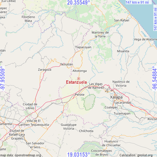
Estanzuela GPS coordinates[2]
19° 41' 41.568" North, 97° 15' 7.056" West
| Map corner | latitude | longitude |
|---|---|---|
| Upper-left | 20.35549°, | -97.95509° |
| Center: | 19.69488°, | -97.25196° |
| Lower-right: | 19.03153°, | -96.54884° |
| Map W x H: | 147.2×147.2 km | = 91.5×91.5mi |
| max Lat: | 32.7° ⇑49.7% North |
| Estanzuela: | 19.69488° |
| min Lat: | ⇓50.3% South 14.53588° |
| min Long | Estanzuela | max Long |
| -117.105° | -97.25196° | -86.73105° |
| W 72%⇐ | ⇒28% E |
Elevation
Elevation of Estanzuela is 2334 m = 7657 ft, and this is 1080.3 m = 3544 ft above average elevation for this country.
| Max E: |
3497 m = 11473 ft | 12.2% |
| Estanzuela | 2334 m 7657 ft | |
| Avg. | 1253.7 m = 4113 ft | |
Min E: |
-1 m = -3 ft | 87.8% |
See also: Mexico elevation on elevation.city.
Geographical zone
Estanzuela is located in North Torrid zone (between Equator and Tropic of Cancer). Distance of this Northern Tropic circle is 416.1 km =258.6 mi to North.| Distance of | km | miles | from Estanzuela |
|---|---|---|---|
| North Pole | 7817.2 | 4857.4 | to North |
| Arctic Circle | 5211.3 | 3238.2 | to North |
| Tropic Cancer | 416.1 | 258.6 | to North |
| Equator | 2189.9 | 1360.7 | to South |


Nearby cities:
15 places around Estanzuela: (largest is in red/bold)
• Adolfo Moreno
3.6 km =2.2 mi,  23°
23°
• Ahueyahualco
2.9 km =1.8 mi,  343°
343°
• Calpulalpan
3.9 km =2.4 mi,  310°
310°
• Champilico
5.2 km =3.2 mi,  350°
350°
• Colonia Libertad
4.6 km =2.9 mi,  115°
115°
• Gutiérrez Zamora
5.1 km =3.2 mi,  49°
49°
• Ignacio Zaragoza
3.4 km =2.1 mi,  55°
55°
• Lerdo de Tejada
1.4 km =0.9 mi,  130°
130°
• Magueyitos
5 km =3.1 mi,  174°
174°
• Mixquiapan
2.9 km =1.8 mi,  284°
284°
• San Miguel Tlalpoalán
5.7 km =3.5 mi,  27°
27°
• Santa Ana
4.2 km =2.6 mi,  272°
272°
• Tepiolulco
2.6 km =1.6 mi, 21°
• Veintiuno de Agosto
4 km =2.5 mi,  327°
327°
• Zoatzingo
3.6 km =2.2 mi,  4°
4°
Sources, notices
• [Note1] Compared only with cities in Mexico existing in our database
• [Src1] Map data: © OpenStreetMap contributors (CC-BY-SA)
• [Src2] Other city data from geonames.org with taken over terms of usage.
• [Src3] Geographical zone / Annual Mean Temperature by Robert A. Rohde @ Wikipedia
