San Miguel Tlalpoalán geodata
San Miguel Tlalpoalán (Veracruz) is a populated place; located in Mexico in America/Mexico_City (GMT-6) time zone. With population of 2,205 people, there are 3980 cities with bigger population in this country. Compared to other cities in Mexico, 51.4% of cities are located further ↓South; 72.2% of cities are located further ←West and 77.2% of cities have lower elevation than San Miguel Tlalpoalán. Note1


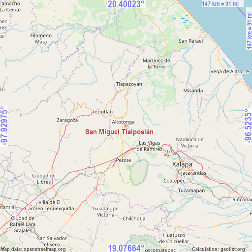
San Miguel Tlalpoalán GPS coordinates[2]
19° 44' 23.316" North, 97° 13' 35.832" West
| Map corner | latitude | longitude |
|---|---|---|
| Upper-left | 20.40023°, | -97.92975° |
| Center: | 19.73981°, | -97.22662° |
| Lower-right: | 19.07664°, | -96.5235° |
| Map W x H: | 147.2×147.2 km | = 91.5×91.5mi |
| max Lat: | 32.7° ⇑48.6% North |
| San Miguel Tlalpoalán: | 19.73981° |
| min Lat: | ⇓51.4% South 14.53588° |
| min Long | San Miguel Tlal | max Long |
| -117.105° | -97.22662° | -86.73105° |
| W 72.2%⇐ | ⇒27.8% E |
Elevation
Elevation of San Miguel Tlalpoalán is 2072 m = 6798 ft, and this is 818.3 m = 2685 ft above average elevation for this country.
| Max E: |
3497 m = 11473 ft | 22.8% |
| San Miguel Tlalpoalán | 2072 m 6798 ft | |
| Avg. | 1253.7 m = 4113 ft | |
Min E: |
-1 m = -3 ft | 77.2% |
See also: Mexico elevation on elevation.city.
Geographical zone
San Miguel Tlalpoalán is located in North Torrid zone (between Equator and Tropic of Cancer). Distance of this Northern Tropic circle is 411.1 km =255.4 mi to North.| Distance of | km | miles | from San Miguel Tlalpoalán |
|---|---|---|---|
| North Pole | 7812.2 | 4854.3 | to North |
| Arctic Circle | 5206.3 | 3235 | to North |
| Tropic Cancer | 411.1 | 255.4 | to North |
| Equator | 2194.9 | 1363.8 | to South |


Nearby cities:
15 places around San Miguel Tlalpoalán: (largest is in red/bold)
• Adolfo Moreno
2.1 km =1.3 mi,  215°
215°
• Ahueyahualco
4.1 km =2.5 mi,  237°
237°
• Altotonga
3.5 km =2.2 mi,  326°
326°
• Atzalan
5.7 km =3.5 mi,  343°
343°
• Buena Vista
1.3 km =0.8 mi,  5°
5°
• Champilico
3.5 km =2.2 mi,  272°
272°
• Estanzuela
5.7 km =3.5 mi,  207°
207°
• Gutiérrez Zamora
2.1 km =1.3 mi,  145°
145°
• Ignacio Zaragoza
3.1 km =1.9 mi,  176°
176°
• Juan Marcos (San José Buenavista)
3.4 km =2.1 mi,  110°
110°
• Tepiolulco
3.1 km =1.9 mi, 213°
• Texacaxco
4.7 km =2.9 mi,  306°
306°
• Veintiuno de Agosto
5 km =3.1 mi,  250°
250°
• Xoampolco
2.3 km =1.4 mi,  352°
352°
• Zoatzingo
2.7 km =1.7 mi, 239°
Sources, notices
• [Note1] Compared only with cities in Mexico existing in our database
• [Src1] Map data: © OpenStreetMap contributors (CC-BY-SA)
• [Src2] Other city data from geonames.org with taken over terms of usage.
• [Src3] Geographical zone / Annual Mean Temperature by Robert A. Rohde @ Wikipedia
