Ciudad Sahagun geodata
Ciudad Sahagun (Hidalgo) is a populated place; located in Mexico in America/Mexico_City (GMT-6) time zone. With population of 28,556 people, there are 349 cities with bigger population in this country. Compared to other cities in Mexico, 52.1% of cities are located further ↓South; 56.4% of cities are located further ←West and 91.3% of cities have lower elevation than Ciudad Sahagun. Note1


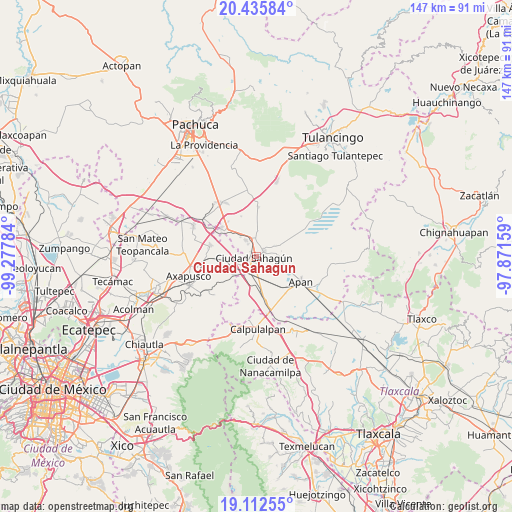
Ciudad Sahagun GPS coordinates[2]
19° 46' 32.052" North, 98° 34' 28.956" West
| Map corner | latitude | longitude |
|---|---|---|
| Upper-left | 20.43584°, | -99.27784° |
| Center: | 19.77557°, | -98.57471° |
| Lower-right: | 19.11255°, | -97.87159° |
| Map W x H: | 147.1×147.1 km | = 91.4×91.4mi |
| max Lat: | 32.7° ⇑47.9% North |
| Ciudad Sahagun: | 19.77557° |
| min Lat: | ⇓52.1% South 14.53588° |
| min Long | Ciudad Sahagun | max Long |
| -117.105° | -98.57471° | -86.73105° |
| W 56.4%⇐ | ⇒43.6% E |
Elevation
Elevation of Ciudad Sahagun is 2455 m = 8054 ft, and this is 1201.3 m = 3941 ft above average elevation for this country.
| Max E: |
3497 m = 11473 ft | 8.7% |
| Ciudad Sahagun | 2455 m 8054 ft | |
| Avg. | 1253.7 m = 4113 ft | |
Min E: |
-1 m = -3 ft | 91.3% |
See also: Mexico elevation on elevation.city.
Geographical zone
Ciudad Sahagun is located in North Torrid zone (between Equator and Tropic of Cancer). Distance of this Northern Tropic circle is 407.1 km =253 mi to North.| Distance of | km | miles | from Ciudad Sahagun |
|---|---|---|---|
| North Pole | 7808.2 | 4851.8 | to North |
| Arctic Circle | 5202.3 | 3232.6 | to North |
| Tropic Cancer | 407.1 | 253 | to North |
| Equator | 2198.8 | 1366.3 | to South |


Nearby cities:
15 places around Ciudad Sahagun: (largest is in red/bold)
• Acopinalco
8.6 km =5.3 mi,  148°
148°
• Chiconcuac
7.2 km =4.5 mi,  320°
320°
• Colonia 20 de Noviembre
7.2 km =4.5 mi,  95°
95°
• Irolo
5.1 km =3.2 mi,  206°
206°
• Jaltepec
8.1 km =5 mi,  230°
230°
• José María Morelos (San José)
10.3 km =6.4 mi,  180°
180°
• La Laguna
9.1 km =5.7 mi,  120°
120°
• Lomas del Pedregal
9.2 km =5.7 mi,  110°
110°
• Los Cides
6.7 km =4.2 mi,  61°
61°
• San Bartolomé Tepetates
4.2 km =2.6 mi,  156°
156°
• San Isidro
2.3 km =1.4 mi,  311°
311°
• Santa Clara
8.5 km =5.3 mi, 182°
• Tepeapulco
2.7 km =1.7 mi, 58°
• Tlanalapa
5.7 km =3.5 mi,  327°
327°
• Xala
7.9 km =4.9 mi,  259°
259°
Sources, notices
• [Note1] Compared only with cities in Mexico existing in our database
• [Src1] Map data: © OpenStreetMap contributors (CC-BY-SA)
• [Src2] Other city data from geonames.org with taken over terms of usage.
• [Src3] Geographical zone / Annual Mean Temperature by Robert A. Rohde @ Wikipedia
