Los Cides geodata
Los Cides (Hidalgo) is a populated place; located in Mexico in America/Mexico_City (GMT-6) time zone. With population of 1,238 people, there are 7007 cities with bigger population in this country. Compared to other cities in Mexico, 52.9% of cities are located further ↓South; 57% of cities are located further ←West and 92.7% of cities have lower elevation than Los Cides. Note1


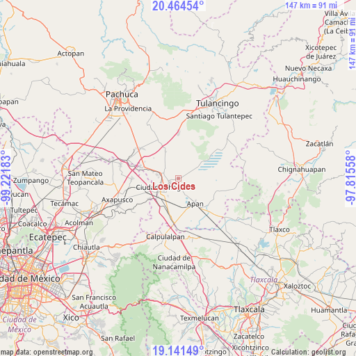
Los Cides GPS coordinates[2]
19° 48' 15.804" North, 98° 31' 7.32" West
| Map corner | latitude | longitude |
|---|---|---|
| Upper-left | 20.46454°, | -99.22183° |
| Center: | 19.80439°, | -98.5187° |
| Lower-right: | 19.14149°, | -97.81558° |
| Map W x H: | 147.1×147.1 km | = 91.4×91.4mi |
| max Lat: | 32.7° ⇑47.1% North |
| Los Cides: | 19.80439° |
| min Lat: | ⇓52.9% South 14.53588° |
| min Long | Los Cides | max Long |
| -117.105° | -98.5187° | -86.73105° |
| W 57%⇐ | ⇒43% E |
Elevation
Elevation of Los Cides is 2515 m = 8251 ft, and this is 1261.3 m = 4138 ft above average elevation for this country.
| Max E: |
3497 m = 11473 ft | 7.3% |
| Los Cides | 2515 m 8251 ft | |
| Avg. | 1253.7 m = 4113 ft | |
Min E: |
-1 m = -3 ft | 92.7% |
See also: Mexico elevation on elevation.city.
Geographical zone
Los Cides is located in North Torrid zone (between Equator and Tropic of Cancer). Distance of this Northern Tropic circle is 403.9 km =251 mi to North.| Distance of | km | miles | from Los Cides |
|---|---|---|---|
| North Pole | 7805 | 4849.8 | to North |
| Arctic Circle | 5199.1 | 3230.6 | to North |
| Tropic Cancer | 403.9 | 251 | to North |
| Equator | 2202 | 1368.3 | to South |


Nearby cities:
15 places around Los Cides: (largest is in red/bold)
• Acopinalco
10.6 km =6.6 mi,  187°
187°
• Apan
12.6 km =7.8 mi,  145°
145°
• Chiconcuac
10.7 km =6.6 mi,  282°
282°
• Ciudad Sahagun
6.7 km =4.2 mi,  241°
241°
• Colonia 20 de Noviembre
4.1 km =2.5 mi,  161°
161°
• Irolo
11.2 km =7 mi,  226°
226°
• La Laguna
8 km =5 mi,  165°
165°
• Lomas del Pedregal
7 km =4.3 mi, 156°
• San Bartolomé Tepetates
8.2 km =5.1 mi,  210°
210°
• San Gabriel Azteca
13.2 km =8.2 mi,  309°
309°
• San Isidro
7.8 km =4.8 mi,  257°
257°
• Santa Clara
13.3 km =8.3 mi, 207°
• Santo Tomas
12.2 km =7.6 mi,  334°
334°
• Tepeapulco
4 km =2.5 mi, 243°
• Tlanalapa
9.1 km =5.7 mi, 280°
Sources, notices
• [Note1] Compared only with cities in Mexico existing in our database
• [Src1] Map data: © OpenStreetMap contributors (CC-BY-SA)
• [Src2] Other city data from geonames.org with taken over terms of usage.
• [Src3] Geographical zone / Annual Mean Temperature by Robert A. Rohde @ Wikipedia
