Casas geodata
Casas (Tamaulipas) is a seat of a second-order administrative division; located in Mexico in America/Monterrey (GMT-6) time zone. With population of 680 people, there are 12778 cities with bigger population in this country. Compared to other cities in Mexico, 89.3% of cities are located further ↓South; 54.6% of cities are located further ←West and 76.7% of cities have higher elevation than Casas. Note1


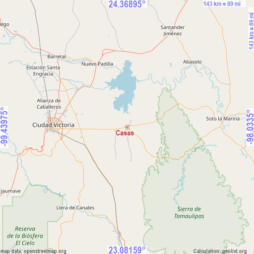
Casas GPS coordinates[2]
23° 43' 36.696" North, 98° 44' 11.832" West
| Map corner | latitude | longitude |
|---|---|---|
| Upper-left | 24.36895°, | -99.43975° |
| Center: | 23.72686°, | -98.73662° |
| Lower-right: | 23.08159°, | -98.0335° |
| Map W x H: | 143.1×143.1 km | = 88.9×88.9mi |
| max Lat: | 32.7° ⇑10.7% North |
| Casas: | 23.72686° |
| min Lat: | ⇓89.3% South 14.53588° |
| min Long | Casas | max Long |
| -117.105° | -98.73662° | -86.73105° |
| W 54.6%⇐ | ⇒45.4% E |
Elevation
Elevation of Casas is 160 m = 525 ft, and this is 1093.7 m = 3588 ft below average elevation for this country.
| Max E: |
3497 m = 11473 ft | 76.7% |
| Avg. | 1253.7 m = 4113 ft | |
| Casas | 160 m = 525 ft | |
Min E: |
-1 m = -3 ft | 23.3% |
See also: Mexico elevation on elevation.city.
Geographical zone
Casas is located in North temperate zone (between Tropic of Cancer and the Arctic Circle). Distance of this Northern Tropic circle is 32.3 km =20.1 mi to South.| Distance of | km | miles | from Casas |
|---|---|---|---|
| North Pole | 7368.9 | 4578.8 | to North |
| Arctic Circle | 4763 | 2959.6 | to North |
| Tropic Cancer | 32.3 | 20.1 | to South |
| Equator | 2638.2 | 1639.3 | to South |


Nearby cities:
15 places around Casas: (largest is in red/bold)
• Aquiles Serdán
41.6 km =25.8 mi,  284°
284°
• Benito Juárez
41 km =25.5 mi, 278°
• Ciudad Victoria
41.7 km =25.9 mi,  272°
272°
• Congregación Caballeros
46.7 km =29 mi,  288°
288°
• El Olmo (Rancho Nuevo del Castillo)
35.7 km =22.2 mi, 265°
• General Pedro José Méndez
49.8 km =30.9 mi,  205°
205°
• Guemes
34.7 km =21.6 mi,  307°
307°
• La Libertad
46.8 km =29.1 mi, 278°
• La Misión
44.9 km =27.9 mi, 280°
• La Presa
44.6 km =27.7 mi, 279°
• Las Compuertas
51.1 km =31.8 mi,  194°
194°
• Manuel Ávila Camacho
27.3 km =17 mi,  257°
257°
• Nueva Villa de Padilla
39.4 km =24.5 mi,  334°
334°
• San Cayetano
41.8 km =26 mi,  298°
298°
• San José de la Flores
43.3 km =26.9 mi, 296°
Sources, notices
• [Note1] Compared only with cities in Mexico existing in our database
• [Src1] Map data: © OpenStreetMap contributors (CC-BY-SA)
• [Src2] Other city data from geonames.org with taken over terms of usage.
• [Src3] Geographical zone / Annual Mean Temperature by Robert A. Rohde @ Wikipedia
