General Pedro José Méndez geodata
General Pedro José Méndez (Tamaulipas) is a populated place; located in Mexico in America/Monterrey (GMT-6) time zone. With population of 621 people, there are 13905 cities with bigger population in this country. Compared to other cities in Mexico, 88.6% of cities are located further ↓South; 51.2% of cities are located further ←West and 74.4% of cities have higher elevation than General Pedro José Méndez. Note1
Current local time in General Pedro José Méndez:
06:48 AM, WednesdayDifference from your time zone: hours


General Pedro José Méndez GPS coordinates[2]
23° 19' 15.42" North, 98° 56' 36.132" West
| Map corner | latitude | longitude |
|---|---|---|
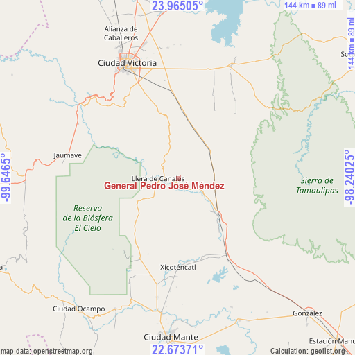
| Upper-left | 23.96505°, | -99.6465° |
| Center: | 23.32095°, | -98.94337° |
| Lower-right: | 22.67371°, | -98.24025° |
| Map W x H: | 143.6×143.6 km | = 89.2×89.2mi |
| max Lat: | 32.7° ⇑11.4% North |
| General Pedro José Méndez: | 23.32095° |
| min Lat: | ⇓88.6% South 14.53588° |
| min Long | General Pedro J | max Long |
| -117.105° | -98.94337° | -86.73105° |
| W 51.2%⇐ | ⇒48.8% E |
Elevation
Elevation of General Pedro José Méndez is 240 m = 787 ft, and this is 1013.7 m = 3326 ft below average elevation for this country.
| Max E: |
3497 m = 11473 ft | 74.4% |
| Avg. | 1253.7 m = 4113 ft | |
| General Pedro José Méndez | 240 m = 787 ft | |
Min E: |
-1 m = -3 ft | 25.6% |
See also: Mexico elevation on elevation.city.
Geographical zone
General Pedro José Méndez is located in North Torrid zone (between Equator and Tropic of Cancer). Distance of this Northern Tropic circle is 12.9 km =8 mi to North.| Distance of | km | miles | from General Pedro José Méndez |
|---|---|---|---|
| North Pole | 7414 | 4606.8 | to North |
| Arctic Circle | 4808.1 | 2987.6 | to North |
| Tropic Cancer | 12.9 | 8 | to North |
| Equator | 2593 | 1611.2 | to South |


Nearby cities:
15 places around General Pedro José Méndez: (largest is in red/bold)
• Casa del Campesino
12 km =7.5 mi,  122°
122°
• El Nuevo Encino (El Encino)
26.7 km =16.6 mi,  220°
220°
• El Olmo (Rancho Nuevo del Castillo)
44.5 km =27.7 mi,  340°
340°
• Emiliano Zapata
4.9 km =3 mi,  157°
157°
• Emiliano Zapata
33.5 km =20.8 mi,  169°
169°
• Gomez Farias
38 km =23.6 mi,  213°
213°
• Ignacio Zaragoza
21.8 km =13.5 mi,  132°
132°
• Jaumave
45.6 km =28.3 mi,  281°
281°
• Juamave
45.6 km =28.3 mi, 281°
• Las Compuertas
9.5 km =5.9 mi, 117°
• Llera de Canales
8.5 km =5.3 mi,  267°
267°
• Manuel Ávila Camacho
39.4 km =24.5 mi,  351°
351°
• Primero de Mayo
40.1 km =24.9 mi,  180°
180°
• Segunda Unidad Xicoténcatl
34.7 km =21.6 mi, 168°
• Xicoténcatl
36.1 km =22.4 mi, 179°
Sources, notices
• [Note1] Compared only with cities in Mexico existing in our database
• [Src1] Map data: © OpenStreetMap contributors (CC-BY-SA)
• [Src2] Other city data from geonames.org with taken over terms of usage.
• [Src3] Geographical zone / Annual Mean Temperature by Robert A. Rohde @ Wikipedia
