Cerro Cantor geodata
Cerro Cantor (Oaxaca) is a populated place; located in Mexico in America/Mexico_City (GMT-6) time zone. With population of 666 people, there are 13039 cities with bigger population in this country. Compared to other cities in Mexico, 97.5% of cities are located further ↑North; 78.9% of cities are located further ←West and 54.3% of cities have higher elevation than Cerro Cantor. Note1


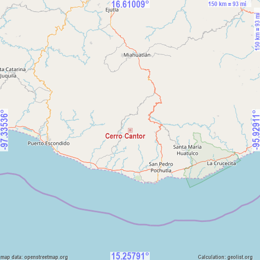
Cerro Cantor GPS coordinates[2]
15° 56' 6.504" North, 96° 37' 56.028" West
| Map corner | latitude | longitude |
|---|---|---|
| Upper-left | 16.61009°, | -97.33536° |
| Center: | 15.93514°, | -96.63223° |
| Lower-right: | 15.25791°, | -95.92911° |
| Map W x H: | 150.3×150.4 km | = 93.4×93.5mi |
| max Lat: | 32.7° ⇑97.5% North |
| Cerro Cantor: | 15.93514° |
| min Lat: | ⇓2.5% South 14.53588° |
| min Long | Cerro Cantor | max Long |
| -117.105° | -96.63223° | -86.73105° |
| W 78.9%⇐ | ⇒21.1% E |
Elevation
Elevation of Cerro Cantor is 1226 m = 4022 ft, and this is 27.7 m = 91 ft below average elevation for this country.
| Max E: |
3497 m = 11473 ft | 54.3% |
| Avg. | 1253.7 m = 4113 ft | |
| Cerro Cantor | 1226 m = 4022 ft | |
Min E: |
-1 m = -3 ft | 45.7% |
See also: Mexico elevation on elevation.city.
Geographical zone
Cerro Cantor is located in North Torrid zone (between Equator and Tropic of Cancer). Distance of this Northern Tropic circle is 834.1 km =518.3 mi to North.| Distance of | km | miles | from Cerro Cantor |
|---|---|---|---|
| North Pole | 8235.2 | 5117.1 | to North |
| Arctic Circle | 5629.4 | 3497.9 | to North |
| Tropic Cancer | 834.1 | 518.3 | to North |
| Equator | 1771.8 | 1100.9 | to South |


Nearby cities:
15 places around Cerro Cantor: (largest is in red/bold)
• Barrio Nuevo
11.6 km =7.2 mi,  192°
192°
• Buenavista Loxicha
8.5 km =5.3 mi,  80°
80°
• El Camalote
7 km =4.3 mi,  172°
172°
• La Sirena
4.6 km =2.9 mi,  331°
331°
• Macahuitera
11.7 km =7.3 mi,  175°
175°
• Magdalena Loxícha
7.3 km =4.5 mi,  239°
239°
• Piedra Virgen
3.6 km =2.2 mi,  293°
293°
• Piedra del Sol
7 km =4.3 mi, 178°
• Quelové
7.3 km =4.5 mi,  316°
316°
• San Agustín Loxicha
9.2 km =5.7 mi,  10°
10°
• San Bartolomé Loxícha
9.1 km =5.7 mi, 294°
• San Francisco Loxicha
3.8 km =2.4 mi,  147°
147°
• San José Piedras Negras
11.8 km =7.3 mi,  158°
158°
• Santa Cruz Loxícha
9.1 km =5.7 mi, 325°
• Santa María Tepejipana
11.5 km =7.1 mi,  104°
104°
Sources, notices
• [Note1] Compared only with cities in Mexico existing in our database
• [Src1] Map data: © OpenStreetMap contributors (CC-BY-SA)
• [Src2] Other city data from geonames.org with taken over terms of usage.
• [Src3] Geographical zone / Annual Mean Temperature by Robert A. Rohde @ Wikipedia
