El Camalote geodata
El Camalote (Oaxaca) is a populated place; located in Mexico in America/Mexico_City (GMT-6) time zone. With population of 1,046 people, there are 8327 cities with bigger population in this country. Compared to other cities in Mexico, 97.6% of cities are located further ↑North; 79% of cities are located further ←West and 72% of cities have higher elevation than El Camalote. Note1


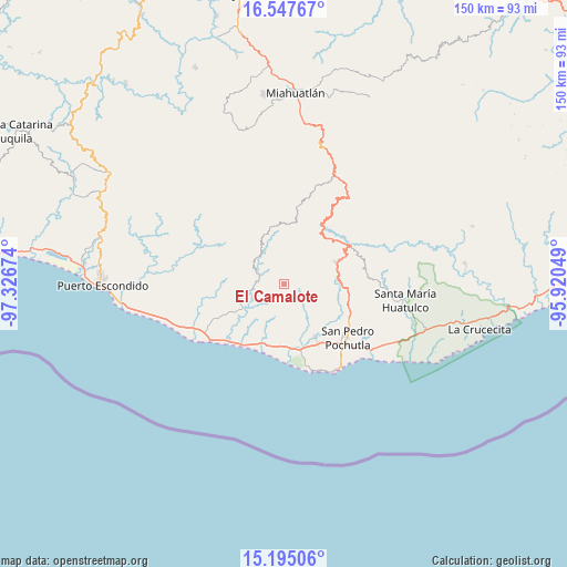
El Camalote GPS coordinates[2]
15° 52' 21" North, 96° 37' 24.996" West
| Map corner | latitude | longitude |
|---|---|---|
| Upper-left | 16.54767°, | -97.32674° |
| Center: | 15.8725°, | -96.62361° |
| Lower-right: | 15.19506°, | -95.92049° |
| Map W x H: | 150.4×150.4 km | = 93.5×93.5mi |
| max Lat: | 32.7° ⇑97.6% North |
| El Camalote: | 15.8725° |
| min Lat: | ⇓2.4% South 14.53588° |
| min Long | El Camalote | max Long |
| -117.105° | -96.62361° | -86.73105° |
| W 79%⇐ | ⇒21% E |
Elevation
Elevation of El Camalote is 329 m = 1079 ft, and this is 924.7 m = 3034 ft below average elevation for this country.
| Max E: |
3497 m = 11473 ft | 72% |
| Avg. | 1253.7 m = 4113 ft | |
| El Camalote | 329 m = 1079 ft | |
Min E: |
-1 m = -3 ft | 28% |
See also: Mexico elevation on elevation.city.
Geographical zone
El Camalote is located in North Torrid zone (between Equator and Tropic of Cancer). Distance of this Northern Tropic circle is 841.1 km =522.6 mi to North.| Distance of | km | miles | from El Camalote |
|---|---|---|---|
| North Pole | 8242.2 | 5121.5 | to North |
| Arctic Circle | 5636.3 | 3502.2 | to North |
| Tropic Cancer | 841.1 | 522.6 | to North |
| Equator | 1764.9 | 1096.7 | to South |


Nearby cities:
15 places around El Camalote: (largest is in red/bold)
• Bajos de Santo Domingo
8.2 km =5.1 mi,  234°
234°
• Barrio Nuevo
5.5 km =3.4 mi,  218°
218°
• Buenavista Loxicha
11.3 km =7 mi,  41°
41°
• Cerro Cantor
7 km =4.3 mi,  352°
352°
• Las Cuevas
7.8 km =4.8 mi,  165°
165°
• Las Pilas
10.3 km =6.4 mi,  214°
214°
• Los Horcones
6.4 km =4 mi,  128°
128°
• Macahuitera
4.7 km =2.9 mi,  181°
181°
• Magdalena Loxícha
8 km =5 mi,  294°
294°
• Piedra Virgen
9.4 km =5.8 mi,  333°
333°
• Piedra del Sol
0.7 km =0.4 mi,  267°
267°
• San Francisco Loxicha
4 km =2.5 mi,  16°
16°
• San José Piedras Negras
5.3 km =3.3 mi,  139°
139°
• Santa María Tepejipana
11 km =6.8 mi,  67°
67°
• Santo Domingo de Morelos
6.3 km =3.9 mi, 227°
Sources, notices
• [Note1] Compared only with cities in Mexico existing in our database
• [Src1] Map data: © OpenStreetMap contributors (CC-BY-SA)
• [Src2] Other city data from geonames.org with taken over terms of usage.
• [Src3] Geographical zone / Annual Mean Temperature by Robert A. Rohde @ Wikipedia
