Cadereyta geodata
Cadereyta (Querétaro) is a seat of a second-order administrative division; located in Mexico in America/Mexico_City (GMT-6) time zone. With population of 13,347 people, there are 731 cities with bigger population in this country. Compared to other cities in Mexico, 71.6% of cities are located further ↓South; 61.6% of cities are located further →East and 75.8% of cities have lower elevation than Cadereyta. Note1


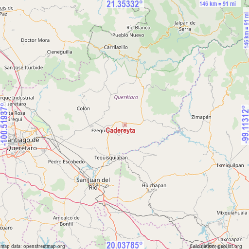
Cadereyta GPS coordinates[2]
20° 41' 49.236" North, 99° 48' 58.464" West
| Map corner | latitude | longitude |
|---|---|---|
| Upper-left | 21.35332°, | -100.51937° |
| Center: | 20.69701°, | -99.81624° |
| Lower-right: | 20.03785°, | -99.11312° |
| Map W x H: | 146.3×146.3 km | = 90.9×90.9mi |
| max Lat: | 32.7° ⇑28.4% North |
| Cadereyta: | 20.69701° |
| min Lat: | ⇓71.6% South 14.53588° |
| min Long | Cadereyta | max Long |
| -117.105° | -99.81624° | -86.73105° |
| W 38.4%⇐ | ⇒61.6% E |
Elevation
Elevation of Cadereyta is 2044 m = 6706 ft, and this is 790.3 m = 2593 ft above average elevation for this country.
| Max E: |
3497 m = 11473 ft | 24.2% |
| Cadereyta | 2044 m 6706 ft | |
| Avg. | 1253.7 m = 4113 ft | |
Min E: |
-1 m = -3 ft | 75.8% |
See also: Mexico elevation on elevation.city.
Geographical zone
Cadereyta is located in North Torrid zone (between Equator and Tropic of Cancer). Distance of this Northern Tropic circle is 304.6 km =189.3 mi to North.| Distance of | km | miles | from Cadereyta |
|---|---|---|---|
| North Pole | 7705.8 | 4788.2 | to North |
| Arctic Circle | 5099.9 | 3168.9 | to North |
| Tropic Cancer | 304.6 | 189.3 | to North |
| Equator | 2301.3 | 1430 | to South |


Nearby cities:
15 places around Cadereyta: (largest is in red/bold)
• Alfredo V. Bonfil (Los Pérez)
6.4 km =4 mi,  266°
266°
• Boxasní
4.5 km =2.8 mi,  229°
229°
• Boyé
8.2 km =5.1 mi,  102°
102°
• El Rincón
5.9 km =3.7 mi,  33°
33°
• Ezequiel Montes
9.4 km =5.8 mi,  247°
247°
• La Nueva Unidad
7.3 km =4.5 mi,  223°
223°
• La Providencia (Las Norbertas)
8.5 km =5.3 mi,  239°
239°
• Puerto de Chiquihuite
2 km =1.2 mi,  282°
282°
• San Martín Florida
6.7 km =4.2 mi,  352°
352°
• Santa Bárbara
5.9 km =3.7 mi,  16°
16°
• Tunas Blancas
6.4 km =4 mi,  285°
285°
• Villa Guerrero
5.8 km =3.6 mi,  89°
89°
• Villa Nueva
3.1 km =1.9 mi,  187°
187°
• Villa Progreso
6.4 km =4 mi,  197°
197°
• Zituní
2.3 km =1.4 mi,  322°
322°
Sources, notices
• [Note1] Compared only with cities in Mexico existing in our database
• [Src1] Map data: © OpenStreetMap contributors (CC-BY-SA)
• [Src2] Other city data from geonames.org with taken over terms of usage.
• [Src3] Geographical zone / Annual Mean Temperature by Robert A. Rohde @ Wikipedia
