Villa Nueva geodata
Villa Nueva (Querétaro) is a populated place; located in Mexico in America/Mexico_City (GMT-6) time zone. With population of 661 people, there are 13143 cities with bigger population in this country. Compared to other cities in Mexico, 71.2% of cities are located further ↓South; 61.7% of cities are located further →East and 81.5% of cities have lower elevation than Villa Nueva. Note1


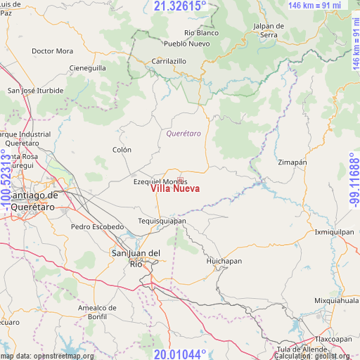
Villa Nueva GPS coordinates[2]
20° 40' 10.992" North, 99° 49' 12" West
| Map corner | latitude | longitude |
|---|---|---|
| Upper-left | 21.32615°, | -100.52313° |
| Center: | 20.66972°, | -99.82° |
| Lower-right: | 20.01044°, | -99.11688° |
| Map W x H: | 146.3×146.3 km | = 90.9×90.9mi |
| max Lat: | 32.7° ⇑28.8% North |
| Villa Nueva: | 20.66972° |
| min Lat: | ⇓71.2% South 14.53588° |
| min Long | Villa Nueva | max Long |
| -117.105° | -99.82° | -86.73105° |
| W 38.3%⇐ | ⇒61.7% E |
Elevation
Elevation of Villa Nueva is 2175 m = 7136 ft, and this is 921.3 m = 3023 ft above average elevation for this country.
| Max E: |
3497 m = 11473 ft | 18.5% |
| Villa Nueva | 2175 m 7136 ft | |
| Avg. | 1253.7 m = 4113 ft | |
Min E: |
-1 m = -3 ft | 81.5% |
See also: Mexico elevation on elevation.city.
Geographical zone
Villa Nueva is located in North Torrid zone (between Equator and Tropic of Cancer). Distance of this Northern Tropic circle is 307.7 km =191.2 mi to North.| Distance of | km | miles | from Villa Nueva |
|---|---|---|---|
| North Pole | 7708.8 | 4790 | to North |
| Arctic Circle | 5102.9 | 3170.8 | to North |
| Tropic Cancer | 307.7 | 191.2 | to North |
| Equator | 2298.3 | 1428.1 | to South |


Nearby cities:
15 places around Villa Nueva: (largest is in red/bold)
• Alfredo V. Bonfil (Los Pérez)
6.6 km =4.1 mi,  293°
293°
• Boxasní
3 km =1.9 mi,  272°
272°
• Boyé
8.5 km =5.3 mi,  81°
81°
• Cadereyta
3.1 km =1.9 mi,  7°
7°
• El Ciervo
7.9 km =4.9 mi,  223°
223°
• El Rincón
8.7 km =5.4 mi,  24°
24°
• Ezequiel Montes
8.3 km =5.2 mi, 266°
• La Nueva Unidad
5.2 km =3.2 mi,  243°
243°
• La Providencia (Las Norbertas)
7 km =4.3 mi,  259°
259°
• Puerto de Chiquihuite
3.8 km =2.4 mi,  335°
335°
• Santa Bárbara
8.9 km =5.5 mi, 13°
• Tunas Blancas
7.4 km =4.6 mi,  309°
309°
• Villa Guerrero
6.9 km =4.3 mi,  63°
63°
• Villa Progreso
3.4 km =2.1 mi,  207°
207°
• Zituní
4.9 km =3 mi,  348°
348°
Sources, notices
• [Note1] Compared only with cities in Mexico existing in our database
• [Src1] Map data: © OpenStreetMap contributors (CC-BY-SA)
• [Src2] Other city data from geonames.org with taken over terms of usage.
• [Src3] Geographical zone / Annual Mean Temperature by Robert A. Rohde @ Wikipedia
