Berriozábal geodata
Berriozábal (Chiapas) is a seat of a second-order administrative division; located in Mexico in America/Mexico_City (GMT-6) time zone. With population of 28,128 people, there are 354 cities with bigger population in this country. Compared to other cities in Mexico, 91.8% of cities are located further ↑North; 87.2% of cities are located further ←West and 61.6% of cities have higher elevation than Berriozábal. Note1


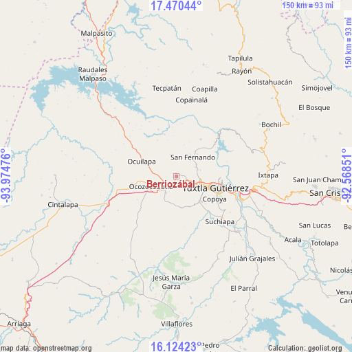
Berriozábal GPS coordinates[2]
16° 47' 54.708" North, 93° 16' 17.868" West
| Map corner | latitude | longitude |
|---|---|---|
| Upper-left | 17.47044°, | -93.97476° |
| Center: | 16.79853°, | -93.27163° |
| Lower-right: | 16.12423°, | -92.56851° |
| Map W x H: | 149.7×149.7 km | = 93×93mi |
| max Lat: | 32.7° ⇑91.8% North |
| Berriozábal: | 16.79853° |
| min Lat: | ⇓8.2% South 14.53588° |
| min Long | Berriozábal | max Long |
| -117.105° | -93.27163° | -86.73105° |
| W 87.2%⇐ | ⇒12.8% E |
Elevation
Elevation of Berriozábal is 904 m = 2966 ft, and this is 349.7 m = 1147 ft below average elevation for this country.
| Max E: |
3497 m = 11473 ft | 61.6% |
| Avg. | 1253.7 m = 4113 ft | |
| Berriozábal | 904 m = 2966 ft | |
Min E: |
-1 m = -3 ft | 38.4% |
See also: Mexico elevation on elevation.city.
Geographical zone
Berriozábal is located in North Torrid zone (between Equator and Tropic of Cancer). Distance of this Northern Tropic circle is 738.1 km =458.6 mi to North.| Distance of | km | miles | from Berriozábal |
|---|---|---|---|
| North Pole | 8139.2 | 5057.5 | to North |
| Arctic Circle | 5533.4 | 3438.3 | to North |
| Tropic Cancer | 738.1 | 458.6 | to North |
| Equator | 1867.8 | 1160.6 | to South |


Nearby cities:
15 places around Berriozábal: (largest is in red/bold)
• Benito Juárez
12.9 km =8 mi,  42°
42°
• Ciudad Maya
8.1 km =5 mi,  215°
215°
• Efraín A. Gutiérrez
9.7 km =6 mi,  343°
343°
• El Copalar
10.7 km =6.6 mi, 35°
• El Portillo
9.5 km =5.9 mi,  34°
34°
• El Progreso
10.2 km =6.3 mi, 31°
• Francisco I. Madero
10.2 km =6.3 mi, 34°
• La Libertad
6.7 km =4.2 mi,  98°
98°
• Miguel Hidalgo
8.3 km =5.2 mi, 25°
• Ocozocoautla de Espinosa
11.7 km =7.3 mi,  249°
249°
• San Fernando
10.6 km =6.6 mi, 40°
• Vicente Guerrero
8.2 km =5.1 mi, 43°
• Villahermosa (Reymundo Enríquez)
8.8 km =5.5 mi,  170°
170°
• Viva Cárdenas
9.3 km =5.8 mi,  63°
63°
• Álvaro Obregón
9.8 km =6.1 mi, 59°
Sources, notices
• [Note1] Compared only with cities in Mexico existing in our database
• [Src1] Map data: © OpenStreetMap contributors (CC-BY-SA)
• [Src2] Other city data from geonames.org with taken over terms of usage.
• [Src3] Geographical zone / Annual Mean Temperature by Robert A. Rohde @ Wikipedia
