Villahermosa (Reymundo Enríquez) geodata
Villahermosa (Reymundo Enríquez) (Chiapas) is a populated place; located in Mexico in America/Mexico_City (GMT-6) time zone. With population of 910 people, there are 9586 cities with bigger population in this country. Compared to other cities in Mexico, 92.6% of cities are located further ↑North; 87.3% of cities are located further ←West and 63.1% of cities have higher elevation than Villahermosa (Reymundo Enríquez). Note1
Current local time in Villahermosa (Reymundo Enríquez):
12:53 AM, WednesdayDifference from your time zone: hours


Villahermosa (Reymundo Enríquez) GPS coordinates[2]
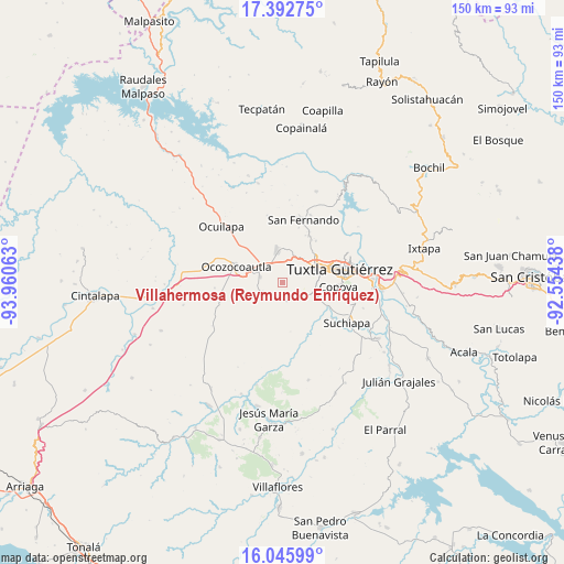
16° 43' 14.016" North, 93° 15' 27" West
| Map corner | latitude | longitude |
|---|---|---|
| Upper-left | 17.39275°, | -93.96063° |
| Center: | 16.72056°, | -93.2575° |
| Lower-right: | 16.04599°, | -92.55438° |
| Map W x H: | 149.7×149.7 km | = 93×93mi |
| max Lat: | 32.7° ⇑92.6% North |
| Villahermosa (Reymundo Enríquez): | 16.72056° |
| min Lat: | ⇓7.4% South 14.53588° |
| min Long | Villahermosa (R | max Long |
| -117.105° | -93.2575° | -86.73105° |
| W 87.3%⇐ | ⇒12.7% E |
Elevation
Elevation of Villahermosa (Reymundo Enríquez) is 810 m = 2657 ft, and this is 443.7 m = 1456 ft below average elevation for this country.
| Max E: |
3497 m = 11473 ft | 63.1% |
| Avg. | 1253.7 m = 4113 ft | |
| Villahermosa (Reymundo Enríquez) | 810 m = 2657 ft | |
Min E: |
-1 m = -3 ft | 36.9% |
See also: Mexico elevation on elevation.city.
Geographical zone
Villahermosa (Reymundo Enríquez) is located in North Torrid zone (between Equator and Tropic of Cancer). Distance of this Northern Tropic circle is 746.8 km =464 mi to North.| Distance of | km | miles | from Villahermosa (Reymundo Enríquez) |
|---|---|---|---|
| North Pole | 8147.9 | 5062.9 | to North |
| Arctic Circle | 5542 | 3443.6 | to North |
| Tropic Cancer | 746.8 | 464 | to North |
| Equator | 1859.2 | 1155.3 | to South |


Nearby cities:
15 places around Villahermosa (Reymundo Enríquez): (largest is in red/bold)
• Berriozábal
8.8 km =5.5 mi,  350°
350°
• Ciudad Maya
6.6 km =4.1 mi,  288°
288°
• Copoya
14.6 km =9.1 mi,  93°
93°
• Emiliano Zapata
5.7 km =3.5 mi,  137°
137°
• Guadalupe Victoria
13.3 km =8.3 mi,  218°
218°
• La Independencia (Las Pilas)
4.9 km =3 mi,  169°
169°
• La Libertad
9.2 km =5.7 mi,  33°
33°
• Miguel Hidalgo
16.3 km =10.1 mi,  7°
7°
• Ocozocoautla de Espinosa
13.3 km =8.3 mi, 290°
• Pacú
16.1 km =10 mi,  125°
125°
• Tuxtla
16 km =9.9 mi,  74°
74°
• Vicente Guerrero
4.5 km =2.8 mi,  185°
185°
• Vicente Guerrero
15.2 km =9.4 mi,  15°
15°
• Viva Cárdenas
14.5 km =9 mi, 28°
• Álvaro Obregón
15.3 km =9.5 mi, 26°
Sources, notices
• [Note1] Compared only with cities in Mexico existing in our database
• [Src1] Map data: © OpenStreetMap contributors (CC-BY-SA)
• [Src2] Other city data from geonames.org with taken over terms of usage.
• [Src3] Geographical zone / Annual Mean Temperature by Robert A. Rohde @ Wikipedia
