El Copalar geodata
El Copalar (Chiapas) is a populated place; located in Mexico in America/Mexico_City (GMT-6) time zone. With population of 2,039 people, there are 4275 cities with bigger population in this country. Compared to other cities in Mexico, 90.7% of cities are located further ↑North; 87.5% of cities are located further ←West and 62.2% of cities have higher elevation than El Copalar. Note1


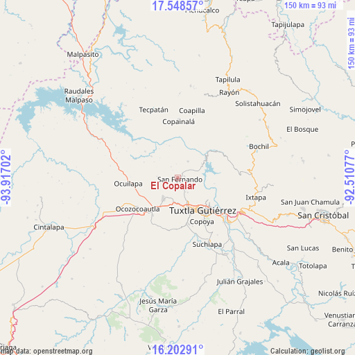
El Copalar GPS coordinates[2]
16° 52' 36.984" North, 93° 12' 50.004" West
| Map corner | latitude | longitude |
|---|---|---|
| Upper-left | 17.54857°, | -93.91702° |
| Center: | 16.87694°, | -93.21389° |
| Lower-right: | 16.20291°, | -92.51077° |
| Map W x H: | 149.6×149.6 km | = 93×93mi |
| max Lat: | 32.7° ⇑90.7% North |
| El Copalar: | 16.87694° |
| min Lat: | ⇓9.3% South 14.53588° |
| min Long | El Copalar | max Long |
| -117.105° | -93.21389° | -86.73105° |
| W 87.5%⇐ | ⇒12.5% E |
Elevation
Elevation of El Copalar is 871 m = 2858 ft, and this is 382.7 m = 1256 ft below average elevation for this country.
| Max E: |
3497 m = 11473 ft | 62.2% |
| Avg. | 1253.7 m = 4113 ft | |
| El Copalar | 871 m = 2858 ft | |
Min E: |
-1 m = -3 ft | 37.8% |
See also: Mexico elevation on elevation.city.
Geographical zone
El Copalar is located in North Torrid zone (between Equator and Tropic of Cancer). Distance of this Northern Tropic circle is 729.4 km =453.2 mi to North.| Distance of | km | miles | from El Copalar |
|---|---|---|---|
| North Pole | 8130.5 | 5052.1 | to North |
| Arctic Circle | 5524.6 | 3432.8 | to North |
| Tropic Cancer | 729.4 | 453.2 | to North |
| Equator | 1876.5 | 1166 | to South |


Nearby cities:
15 places around El Copalar: (largest is in red/bold)
• Benito Juárez
2.7 km =1.7 mi,  74°
74°
• Berriozábal
10.7 km =6.6 mi,  215°
215°
• Cuauhtémoc
6 km =3.7 mi,  352°
352°
• Efraín A. Gutiérrez
8.9 km =5.5 mi,  273°
273°
• El Portillo
1.2 km =0.7 mi, 223°
• El Progreso
0.9 km =0.6 mi, 270°
• Francisco I. Madero
0.4 km =0.2 mi,  226°
226°
• Gabriel Esquinca
8.2 km =5.1 mi,  29°
29°
• La Libertad
9.7 km =6 mi,  177°
177°
• Miguel Hidalgo
2.8 km =1.7 mi,  244°
244°
• Monterrey
5.6 km =3.5 mi,  328°
328°
• San Fernando
0.9 km =0.6 mi,  131°
131°
• Vicente Guerrero
2.8 km =1.7 mi,  189°
189°
• Viva Cárdenas
5.1 km =3.2 mi,  154°
154°
• Álvaro Obregón
4.3 km =2.7 mi, 148°
Sources, notices
• [Note1] Compared only with cities in Mexico existing in our database
• [Src1] Map data: © OpenStreetMap contributors (CC-BY-SA)
• [Src2] Other city data from geonames.org with taken over terms of usage.
• [Src3] Geographical zone / Annual Mean Temperature by Robert A. Rohde @ Wikipedia
