Almanza geodata
Almanza (Veracruz) is a populated place; located in Mexico in America/Mexico_City (GMT-6) time zone. With population of 628 people, there are 13781 cities with bigger population in this country. Compared to other cities in Mexico, 56.4% of cities are located further ↓South; 74.3% of cities are located further ←West and 71.9% of cities have higher elevation than Almanza. Note1


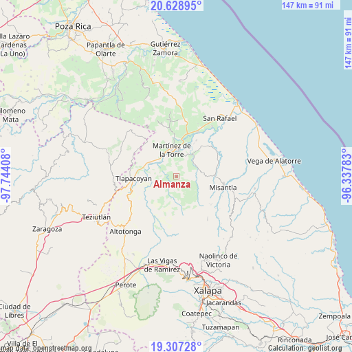
Almanza GPS coordinates[2]
19° 58' 10.2" North, 97° 2' 27.42" West
| Map corner | latitude | longitude |
|---|---|---|
| Upper-left | 20.62895°, | -97.74408° |
| Center: | 19.9695°, | -97.04095° |
| Lower-right: | 19.30728°, | -96.33783° |
| Map W x H: | 147×147 km | = 91.3×91.3mi |
| max Lat: | 32.7° ⇑43.6% North |
| Almanza: | 19.9695° |
| min Lat: | ⇓56.4% South 14.53588° |
| min Long | Almanza | max Long |
| -117.105° | -97.04095° | -86.73105° |
| W 74.3%⇐ | ⇒25.7% E |
Elevation
Elevation of Almanza is 331 m = 1086 ft, and this is 922.7 m = 3027 ft below average elevation for this country.
| Max E: |
3497 m = 11473 ft | 71.9% |
| Avg. | 1253.7 m = 4113 ft | |
| Almanza | 331 m = 1086 ft | |
Min E: |
-1 m = -3 ft | 28.1% |
See also: Mexico elevation on elevation.city.
Geographical zone
Almanza is located in North Torrid zone (between Equator and Tropic of Cancer). Distance of this Northern Tropic circle is 385.5 km =239.5 mi to North.| Distance of | km | miles | from Almanza |
|---|---|---|---|
| North Pole | 7786.7 | 4838.4 | to North |
| Arctic Circle | 5180.8 | 3219.2 | to North |
| Tropic Cancer | 385.5 | 239.5 | to North |
| Equator | 2220.4 | 1379.7 | to South |


Nearby cities:
15 places around Almanza: (largest is in red/bold)
• Colonias Pedernales
8.6 km =5.3 mi,  352°
352°
• El Azotal
6.6 km =4.1 mi,  144°
144°
• Francisco Sarabia
9.1 km =5.7 mi,  53°
53°
• Ignacio Zaragoza
10.2 km =6.3 mi,  80°
80°
• Ixtacuaco
10.8 km =6.7 mi,  330°
330°
• Javier Rojo Gómez (Novara)
8.3 km =5.2 mi,  318°
318°
• Luis Echeverría
11.4 km =7.1 mi, 330°
• Pahua Hueca
1.7 km =1.1 mi,  238°
238°
• Plan de Arroyos
11.1 km =6.9 mi,  219°
219°
• Plan de Limón
10.8 km =6.7 mi,  31°
31°
• Pompeya
6.7 km =4.2 mi,  339°
339°
• Pueblo Viejo Dos
9.8 km =6.1 mi,  12°
12°
• San Pedro Tlapacoyan
11.5 km =7.1 mi, 328°
• Tierra Nueva
4.2 km =2.6 mi, 142°
• Villa Independencia
9.6 km =6 mi, 353°
Sources, notices
• [Note1] Compared only with cities in Mexico existing in our database
• [Src1] Map data: © OpenStreetMap contributors (CC-BY-SA)
• [Src2] Other city data from geonames.org with taken over terms of usage.
• [Src3] Geographical zone / Annual Mean Temperature by Robert A. Rohde @ Wikipedia
