Plan de Arroyos geodata
Plan de Arroyos (Veracruz) is a populated place; located in Mexico in America/Mexico_City (GMT-6) time zone. With population of 2,915 people, there are 3054 cities with bigger population in this country. Compared to other cities in Mexico, 54.9% of cities are located further ↓South; 73.5% of cities are located further ←West and 63.4% of cities have higher elevation than Plan de Arroyos. Note1


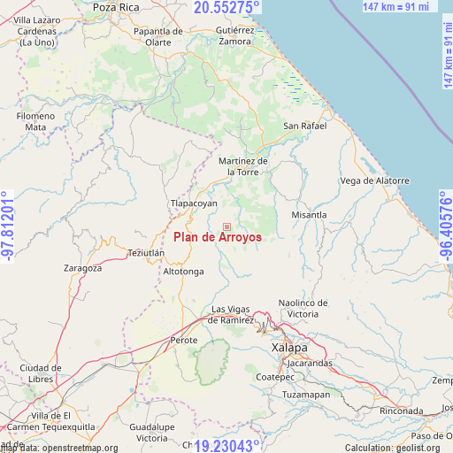
Plan de Arroyos GPS coordinates[2]
19° 53' 34.692" North, 97° 6' 31.968" West
| Map corner | latitude | longitude |
|---|---|---|
| Upper-left | 20.55275°, | -97.81201° |
| Center: | 19.89297°, | -97.10888° |
| Lower-right: | 19.23043°, | -96.40576° |
| Map W x H: | 147×147 km | = 91.3×91.3mi |
| max Lat: | 32.7° ⇑45.1% North |
| Plan de Arroyos: | 19.89297° |
| min Lat: | ⇓54.9% South 14.53588° |
| min Long | Plan de Arroyos | max Long |
| -117.105° | -97.10888° | -86.73105° |
| W 73.5%⇐ | ⇒26.5% E |
Elevation
Elevation of Plan de Arroyos is 793 m = 2602 ft, and this is 460.7 m = 1511 ft below average elevation for this country.
| Max E: |
3497 m = 11473 ft | 63.4% |
| Avg. | 1253.7 m = 4113 ft | |
| Plan de Arroyos | 793 m = 2602 ft | |
Min E: |
-1 m = -3 ft | 36.6% |
See also: Mexico elevation on elevation.city.
Geographical zone
Plan de Arroyos is located in North Torrid zone (between Equator and Tropic of Cancer). Distance of this Northern Tropic circle is 394 km =244.8 mi to North.| Distance of | km | miles | from Plan de Arroyos |
|---|---|---|---|
| North Pole | 7795.2 | 4843.7 | to North |
| Arctic Circle | 5189.3 | 3224.5 | to North |
| Tropic Cancer | 394 | 244.8 | to North |
| Equator | 2211.9 | 1374.4 | to South |


Nearby cities:
15 places around Plan de Arroyos: (largest is in red/bold)
• Ahuateno
3.3 km =2.1 mi,  294°
294°
• Almanza
11.1 km =6.9 mi,  39°
39°
• Cuauzapotitán
7.9 km =4.9 mi,  276°
276°
• El Azotal
11.4 km =7.1 mi,  74°
74°
• El Campamento
8.9 km =5.5 mi,  315°
315°
• La Prensa
10.9 km =6.8 mi,  166°
166°
• Las Truchas
12.2 km =7.6 mi, 168°
• Mexcalteco
7.9 km =4.9 mi,  186°
186°
• Napoala
11.9 km =7.4 mi, 276°
• Pahua Hueca
9.5 km =5.9 mi, 36°
• Santa Cruz
12.5 km =7.8 mi, 293°
• Santiago
5.4 km =3.4 mi,  299°
299°
• Temimilco
10 km =6.2 mi, 171°
• Tierra Nueva
10.9 km =6.8 mi,  61°
61°
• Zapotitlán
8.4 km =5.2 mi,  211°
211°
Sources, notices
• [Note1] Compared only with cities in Mexico existing in our database
• [Src1] Map data: © OpenStreetMap contributors (CC-BY-SA)
• [Src2] Other city data from geonames.org with taken over terms of usage.
• [Src3] Geographical zone / Annual Mean Temperature by Robert A. Rohde @ Wikipedia
