Lachicocana geodata
Lachicocana (Oaxaca) is a populated place; located in Mexico in America/Mexico_City (GMT-6) time zone. With population of 612 people, there are 14088 cities with bigger population in this country. Compared to other cities in Mexico, 88.1% of cities are located further ↑North; 81.6% of cities are located further ←West and 57.7% of cities have lower elevation than Lachicocana. Note1


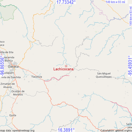
Lachicocana GPS coordinates[2]
17° 3' 44.892" North, 96° 9' 44.748" West
| Map corner | latitude | longitude |
|---|---|---|
| Upper-left | 17.73342°, | -96.86556° |
| Center: | 17.06247°, | -96.16243° |
| Lower-right: | 16.3891°, | -95.45931° |
| Map W x H: | 149.5×149.5 km | = 92.9×92.9mi |
| max Lat: | 32.7° ⇑88.1% North |
| Lachicocana: | 17.06247° |
| min Lat: | ⇓11.9% South 14.53588° |
| min Long | Lachicocana | max Long |
| -117.105° | -96.16243° | -86.73105° |
| W 81.6%⇐ | ⇒18.4% E |
Elevation
Elevation of Lachicocana is 1683 m = 5522 ft, and this is 429.3 m = 1408 ft above average elevation for this country.
| Max E: |
3497 m = 11473 ft | 42.3% |
| Lachicocana | 1683 m 5522 ft | |
| Avg. | 1253.7 m = 4113 ft | |
Min E: |
-1 m = -3 ft | 57.7% |
See also: Mexico elevation on elevation.city.
Geographical zone
Lachicocana is located in North Torrid zone (between Equator and Tropic of Cancer). Distance of this Northern Tropic circle is 708.8 km =440.4 mi to North.| Distance of | km | miles | from Lachicocana |
|---|---|---|---|
| North Pole | 8109.9 | 5039.3 | to North |
| Arctic Circle | 5504 | 3420 | to North |
| Tropic Cancer | 708.8 | 440.4 | to North |
| Equator | 1897.2 | 1178.9 | to South |


Nearby cities:
15 places around Lachicocana: (largest is in red/bold)
• Albarradas
4 km =2.5 mi,  277°
277°
• Ayutla
9.9 km =6.2 mi,  112°
112°
• Chichicaxtepec
13.6 km =8.5 mi,  33°
33°
• El Duraznal
3.5 km =2.2 mi,  188°
188°
• Guadalupe Victoria
13.7 km =8.5 mi,  86°
86°
• Mixistlán
11 km =6.8 mi,  38°
38°
• San Mateo Cajonos
12 km =7.5 mi,  336°
336°
• Santa Ana
12 km =7.5 mi,  72°
72°
• Santa María Albarradas
11.2 km =7 mi,  195°
195°
• Tamazulapam
10.4 km =6.5 mi, 94°
• Tamazulápam del Espíritu Santo
10.4 km =6.5 mi, 94°
• Tierra Blanca
12.9 km =8 mi, 107°
• Tlahuitoltepec
11.3 km =7 mi, 69°
• Villa Hidalgo
13.6 km =8.5 mi,  352°
352°
• Yaganiza
11.6 km =7.2 mi,  322°
322°
Sources, notices
• [Note1] Compared only with cities in Mexico existing in our database
• [Src1] Map data: © OpenStreetMap contributors (CC-BY-SA)
• [Src2] Other city data from geonames.org with taken over terms of usage.
• [Src3] Geographical zone / Annual Mean Temperature by Robert A. Rohde @ Wikipedia
