Chichicaxtepec geodata
Chichicaxtepec (Oaxaca) is a populated place; located in Mexico in America/Mexico_City (GMT-6) time zone. With population of 596 people, there are 14429 cities with bigger population in this country. Compared to other cities in Mexico, 86.9% of cities are located further ↑North; 81.9% of cities are located further ←West and 69.5% of cities have lower elevation than Chichicaxtepec. Note1


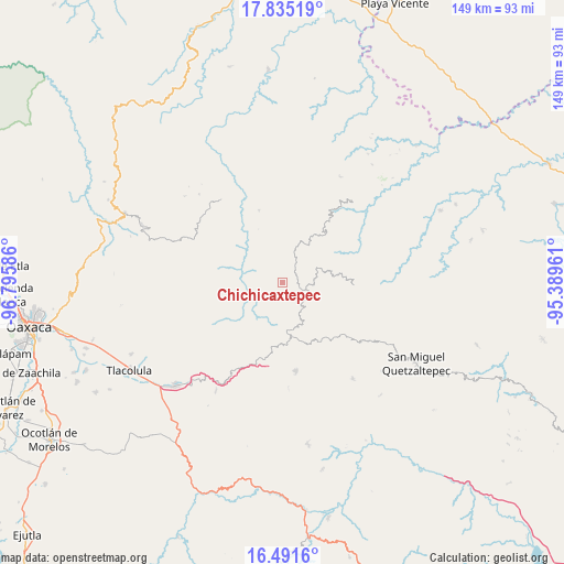
Chichicaxtepec GPS coordinates[2]
17° 9' 52.596" North, 96° 5' 33.828" West
| Map corner | latitude | longitude |
|---|---|---|
| Upper-left | 17.83519°, | -96.79586° |
| Center: | 17.16461°, | -96.09273° |
| Lower-right: | 16.4916°, | -95.38961° |
| Map W x H: | 149.4×149.4 km | = 92.8×92.8mi |
| max Lat: | 32.7° ⇑86.9% North |
| Chichicaxtepec: | 17.16461° |
| min Lat: | ⇓13.1% South 14.53588° |
| min Long | Chichicaxtepec | max Long |
| -117.105° | -96.09273° | -86.73105° |
| W 81.9%⇐ | ⇒18.1% E |
Elevation
Elevation of Chichicaxtepec is 1916 m = 6286 ft, and this is 662.3 m = 2173 ft above average elevation for this country.
| Max E: |
3497 m = 11473 ft | 30.5% |
| Chichicaxtepec | 1916 m 6286 ft | |
| Avg. | 1253.7 m = 4113 ft | |
Min E: |
-1 m = -3 ft | 69.5% |
See also: Mexico elevation on elevation.city.
Geographical zone
Chichicaxtepec is located in North Torrid zone (between Equator and Tropic of Cancer). Distance of this Northern Tropic circle is 697.4 km =433.3 mi to North.| Distance of | km | miles | from Chichicaxtepec |
|---|---|---|---|
| North Pole | 8098.5 | 5032.2 | to North |
| Arctic Circle | 5492.6 | 3412.9 | to North |
| Tropic Cancer | 697.4 | 433.3 | to North |
| Equator | 1908.5 | 1185.9 | to South |


Nearby cities:
15 places around Chichicaxtepec: (largest is in red/bold)
• Guadalupe Victoria
12.2 km =7.6 mi,  149°
149°
• Lachicocana
13.6 km =8.5 mi,  213°
213°
• Mixistlán
2.8 km =1.7 mi,  193°
193°
• San Francisco Jayacaxtepec
14 km =8.7 mi,  63°
63°
• San Mateo Cajonos
12.2 km =7.6 mi,  268°
268°
• San Melchor Betaza
11.7 km =7.3 mi,  326°
326°
• Santa Ana
8.7 km =5.4 mi, 152°
• Santa María Tiltepec
7.6 km =4.7 mi,  356°
356°
• Tamazulapam
12.5 km =7.8 mi,  166°
166°
• Tamazulápam del Espíritu Santo
12.5 km =7.8 mi, 166°
• Tlahuitoltepec
8.1 km =5 mi,  156°
156°
• Totontepec Villa de Morelos
12.3 km =7.6 mi,  33°
33°
• Villa Hidalgo
9.3 km =5.8 mi,  283°
283°
• Yacochi
5.2 km =3.2 mi,  120°
120°
• Yaganiza
14.7 km =9.1 mi,  261°
261°
Sources, notices
• [Note1] Compared only with cities in Mexico existing in our database
• [Src1] Map data: © OpenStreetMap contributors (CC-BY-SA)
• [Src2] Other city data from geonames.org with taken over terms of usage.
• [Src3] Geographical zone / Annual Mean Temperature by Robert A. Rohde @ Wikipedia
