Villa Hidalgo geodata
Villa Hidalgo (Oaxaca) is a seat of a second-order administrative division; located in Mexico in America/Mexico_City (GMT-6) time zone. With population of 1,844 people, there are 4710 cities with bigger population in this country. Compared to other cities in Mexico, 86.7% of cities are located further ↑North; 81.5% of cities are located further ←West and 54.1% of cities have higher elevation than Villa Hidalgo. Note1


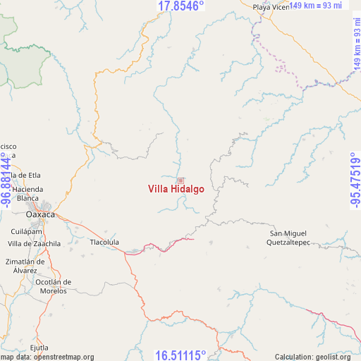
Villa Hidalgo GPS coordinates[2]
17° 11' 2.724" North, 96° 10' 41.916" West
| Map corner | latitude | longitude |
|---|---|---|
| Upper-left | 17.8546°, | -96.88144° |
| Center: | 17.18409°, | -96.17831° |
| Lower-right: | 16.51115°, | -95.47519° |
| Map W x H: | 149.4×149.4 km | = 92.8×92.8mi |
| max Lat: | 32.7° ⇑86.7% North |
| Villa Hidalgo: | 17.18409° |
| min Lat: | ⇓13.3% South 14.53588° |
| min Long | Villa Hidalgo | max Long |
| -117.105° | -96.17831° | -86.73105° |
| W 81.5%⇐ | ⇒18.5% E |
Elevation
Elevation of Villa Hidalgo is 1237 m = 4058 ft, and this is 16.7 m = 55 ft below average elevation for this country.
| Max E: |
3497 m = 11473 ft | 54.1% |
| Avg. | 1253.7 m = 4113 ft | |
| Villa Hidalgo | 1237 m = 4058 ft | |
Min E: |
-1 m = -3 ft | 45.9% |
See also: Mexico elevation on elevation.city.
Geographical zone
Villa Hidalgo is located in North Torrid zone (between Equator and Tropic of Cancer). Distance of this Northern Tropic circle is 695.2 km =432 mi to North.| Distance of | km | miles | from Villa Hidalgo |
|---|---|---|---|
| North Pole | 8096.4 | 5030.9 | to North |
| Arctic Circle | 5490.5 | 3411.6 | to North |
| Tropic Cancer | 695.2 | 432 | to North |
| Equator | 1910.7 | 1187.3 | to South |


Nearby cities:
15 places around Villa Hidalgo: (largest is in red/bold)
• Cajonos
9 km =5.6 mi,  258°
258°
• Chichicaxtepec
9.3 km =5.8 mi,  103°
103°
• Mixistlán
9.8 km =6.1 mi,  119°
119°
• San Andrés Solaga
11.6 km =7.2 mi,  328°
328°
• San Andrés Yaá
12.4 km =7.7 mi,  12°
12°
• San Francisco Cajonos
7.8 km =4.8 mi, 259°
• San Mateo Cajonos
4 km =2.5 mi,  231°
231°
• San Melchor Betaza
8.1 km =5 mi,  19°
19°
• Santa María Tiltepec
10.2 km =6.3 mi,  58°
58°
• Santiago Zoochila
7.9 km =4.9 mi,  300°
300°
• Xagacía
10 km =6.2 mi,  250°
250°
• Yaganiza
7 km =4.3 mi, 231°
• Yalina
10.9 km =6.8 mi, 304°
• Yatzachi
6.5 km =4 mi,  315°
315°
• Zoogocho
9.3 km =5.8 mi,  312°
312°
Sources, notices
• [Note1] Compared only with cities in Mexico existing in our database
• [Src1] Map data: © OpenStreetMap contributors (CC-BY-SA)
• [Src2] Other city data from geonames.org with taken over terms of usage.
• [Src3] Geographical zone / Annual Mean Temperature by Robert A. Rohde @ Wikipedia
