Río Pachiñe geodata
Río Pachiñe (Oaxaca) is a populated place; located in Mexico in America/Mexico_City (GMT-6) time zone. With population of 1,275 people, there are 6794 cities with bigger population in this country. Compared to other cities in Mexico, 89.3% of cities are located further ↑North; 84.4% of cities are located further ←West and 77.2% of cities have higher elevation than Río Pachiñe. Note1


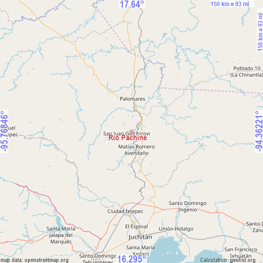
Río Pachiñe GPS coordinates[2]
16° 58' 7.32" North, 95° 3' 55.188" West
| Map corner | latitude | longitude |
|---|---|---|
| Upper-left | 17.64°, | -95.76846° |
| Center: | 16.9687°, | -95.06533° |
| Lower-right: | 16.295°, | -94.36221° |
| Map W x H: | 149.5×149.6 km | = 92.9×93mi |
| max Lat: | 32.7° ⇑89.3% North |
| Río Pachiñe: | 16.9687° |
| min Lat: | ⇓10.7% South 14.53588° |
| min Long | Río Pachiñe | max Long |
| -117.105° | -95.06533° | -86.73105° |
| W 84.4%⇐ | ⇒15.6% E |
Elevation
Elevation of Río Pachiñe is 148 m = 486 ft, and this is 1105.7 m = 3628 ft below average elevation for this country.
| Max E: |
3497 m = 11473 ft | 77.2% |
| Avg. | 1253.7 m = 4113 ft | |
| Río Pachiñe | 148 m = 486 ft | |
Min E: |
-1 m = -3 ft | 22.8% |
See also: Mexico elevation on elevation.city.
Geographical zone
Río Pachiñe is located in North Torrid zone (between Equator and Tropic of Cancer). Distance of this Northern Tropic circle is 719.2 km =446.9 mi to North.| Distance of | km | miles | from Río Pachiñe |
|---|---|---|---|
| North Pole | 8120.3 | 5045.7 | to North |
| Arctic Circle | 5514.4 | 3426.5 | to North |
| Tropic Cancer | 719.2 | 446.9 | to North |
| Equator | 1886.7 | 1172.3 | to South |


Nearby cities:
15 places around Río Pachiñe: (largest is in red/bold)
• Barreña
11.5 km =7.1 mi,  107°
107°
• Boca del Monte
11.6 km =7.2 mi,  26°
26°
• Colonia Rincón Viejo
9.3 km =5.8 mi,  168°
168°
• El Bajío
9.4 km =5.8 mi,  160°
160°
• El Chocolate
4.8 km =3 mi,  212°
212°
• Encinal Colorado
6.4 km =4 mi,  315°
315°
• Estación Mogoñé
4.2 km =2.6 mi,  46°
46°
• Hidalgo Norte
10 km =6.2 mi, 171°
• Llano Suchiapa
11.5 km =7.1 mi, 173°
• Matías Romero
10.3 km =6.4 mi, 164°
• Mogoñé Viejo
5.9 km =3.7 mi, 45°
• Piedra Blanca
6 km =3.7 mi,  68°
68°
• San Juan Guichicovi
3.1 km =1.9 mi,  256°
256°
• Santa Ana
9.8 km =6.1 mi,  347°
347°
• Zarzal
5.9 km =3.7 mi, 30°
Sources, notices
• [Note1] Compared only with cities in Mexico existing in our database
• [Src1] Map data: © OpenStreetMap contributors (CC-BY-SA)
• [Src2] Other city data from geonames.org with taken over terms of usage.
• [Src3] Geographical zone / Annual Mean Temperature by Robert A. Rohde @ Wikipedia
