Barreña geodata
Barreña (Oaxaca) is a populated place; located in Mexico in America/Mexico_City (GMT-6) time zone. With population of 559 people, there are 15266 cities with bigger population in this country. Compared to other cities in Mexico, 89.8% of cities are located further ↑North; 84.7% of cities are located further ←West and 78.1% of cities have higher elevation than Barreña. Note1


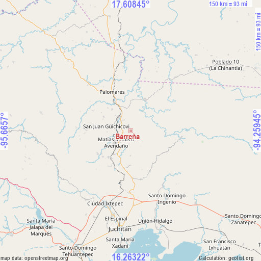
Barreña GPS coordinates[2]
16° 56' 13.344" North, 94° 57' 45.252" West
| Map corner | latitude | longitude |
|---|---|---|
| Upper-left | 17.60845°, | -95.6657° |
| Center: | 16.93704°, | -94.96257° |
| Lower-right: | 16.26322°, | -94.25945° |
| Map W x H: | 149.6×149.6 km | = 93×93mi |
| max Lat: | 32.7° ⇑89.8% North |
| Barreña: | 16.93704° |
| min Lat: | ⇓10.2% South 14.53588° |
| min Long | Barreña | max Long |
| -117.105° | -94.96257° | -86.73105° |
| W 84.7%⇐ | ⇒15.3% E |
Elevation
Elevation of Barreña is 129 m = 423 ft, and this is 1124.7 m = 3690 ft below average elevation for this country.
| Max E: |
3497 m = 11473 ft | 78.1% |
| Avg. | 1253.7 m = 4113 ft | |
| Barreña | 129 m = 423 ft | |
Min E: |
-1 m = -3 ft | 21.9% |
See also: Mexico elevation on elevation.city.
Geographical zone
Barreña is located in North Torrid zone (between Equator and Tropic of Cancer). Distance of this Northern Tropic circle is 722.7 km =449.1 mi to North.| Distance of | km | miles | from Barreña |
|---|---|---|---|
| North Pole | 8123.8 | 5047.9 | to North |
| Arctic Circle | 5518 | 3428.7 | to North |
| Tropic Cancer | 722.7 | 449.1 | to North |
| Equator | 1883.2 | 1170.2 | to South |


Nearby cities:
15 places around Barreña: (largest is in red/bold)
• Boca del Monte
15.1 km =9.4 mi,  337°
337°
• Buenavista
16.7 km =10.4 mi,  219°
219°
• Chivixhuyo
14 km =8.7 mi,  180°
180°
• Colonia Rincón Viejo
10.6 km =6.6 mi,  238°
238°
• El Bajío
9.4 km =5.8 mi, 235°
• El Chocolate
13.5 km =8.4 mi,  267°
267°
• Estación Mogoñé
10.2 km =6.3 mi,  309°
309°
• Hidalgo Norte
11.5 km =7.1 mi, 236°
• Llano Suchiapa
12.5 km =7.8 mi,  230°
230°
• Matías Romero
10.4 km =6.5 mi, 231°
• Mogoñé Viejo
10.2 km =6.3 mi,  318°
318°
• Piedra Blanca
7.8 km =4.8 mi, 317°
• Río Pachiñe
11.5 km =7.1 mi,  287°
287°
• San Juan Guichicovi
14.3 km =8.9 mi,  281°
281°
• Zarzal
11.7 km =7.3 mi, 317°
Sources, notices
• [Note1] Compared only with cities in Mexico existing in our database
• [Src1] Map data: © OpenStreetMap contributors (CC-BY-SA)
• [Src2] Other city data from geonames.org with taken over terms of usage.
• [Src3] Geographical zone / Annual Mean Temperature by Robert A. Rohde @ Wikipedia
