Silacayoápam geodata
Silacayoápam (Oaxaca) is a seat of a second-order administrative division; located in Mexico in America/Mexico_City (GMT-6) time zone. With population of 2,090 people, there are 4173 cities with bigger population in this country. Compared to other cities in Mexico, 83.1% of cities are located further ↑North; 62.1% of cities are located further ←West and 56.7% of cities have lower elevation than Silacayoápam. Note1


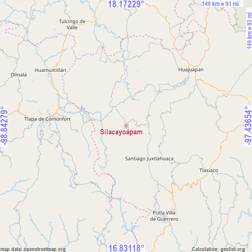
Silacayoápam GPS coordinates[2]
17° 30' 10.692" North, 98° 8' 22.776" West
| Map corner | latitude | longitude |
|---|---|---|
| Upper-left | 18.17229°, | -98.84279° |
| Center: | 17.50297°, | -98.13966° |
| Lower-right: | 16.83118°, | -97.43654° |
| Map W x H: | 149.1×149.1 km | = 92.6×92.6mi |
| max Lat: | 32.7° ⇑83.1% North |
| Silacayoápam: | 17.50297° |
| min Lat: | ⇓16.9% South 14.53588° |
| min Long | Silacayoápam | max Long |
| -117.105° | -98.13966° | -86.73105° |
| W 62.1%⇐ | ⇒37.9% E |
Elevation
Elevation of Silacayoápam is 1644 m = 5394 ft, and this is 390.3 m = 1281 ft above average elevation for this country.
| Max E: |
3497 m = 11473 ft | 43.3% |
| Silacayoápam | 1644 m 5394 ft | |
| Avg. | 1253.7 m = 4113 ft | |
Min E: |
-1 m = -3 ft | 56.7% |
See also: Mexico elevation on elevation.city.
Geographical zone
Silacayoápam is located in North Torrid zone (between Equator and Tropic of Cancer). Distance of this Northern Tropic circle is 659.8 km =410 mi to North.| Distance of | km | miles | from Silacayoápam |
|---|---|---|---|
| North Pole | 8060.9 | 5008.8 | to North |
| Arctic Circle | 5455 | 3389.6 | to North |
| Tropic Cancer | 659.8 | 410 | to North |
| Equator | 1946.1 | 1209.3 | to South |


Nearby cities:
15 places around Silacayoápam: (largest is in red/bold)
• Ahuajutla
17.9 km =11.1 mi,  243°
243°
• Calihualá
15 km =9.3 mi,  282°
282°
• Guadalupe Nogales
18.1 km =11.2 mi,  261°
261°
• Guadalupe de Morelos
19.5 km =12.1 mi,  9°
9°
• Ixpantepec Nieves
10.3 km =6.4 mi,  87°
87°
• San Agustín Atenango
18.2 km =11.3 mi,  48°
48°
• San Francisco Tlapancingo
13.8 km =8.6 mi, 260°
• San Jerónimo Nuchita
16.4 km =10.2 mi,  17°
17°
• San Jorge Nuchita
17.5 km =10.9 mi, 12°
• San Lorenzo
18.5 km =11.5 mi, 6°
• San Martín Peras
19 km =11.8 mi,  212°
212°
• San Miguel Tlacotepec
15.2 km =9.4 mi,  110°
110°
• Santa Cruz de Bravo
12.4 km =7.7 mi,  314°
314°
• Santiago Nuxaño
17.4 km =10.8 mi,  129°
129°
• Yucuyachi
13.2 km =8.2 mi,  332°
332°
Sources, notices
• [Note1] Compared only with cities in Mexico existing in our database
• [Src1] Map data: © OpenStreetMap contributors (CC-BY-SA)
• [Src2] Other city data from geonames.org with taken over terms of usage.
• [Src3] Geographical zone / Annual Mean Temperature by Robert A. Rohde @ Wikipedia
