San Jorge Nuchita geodata
San Jorge Nuchita (Oaxaca) is a seat of a second-order administrative division; located in Mexico in America/Mexico_City (GMT-6) time zone. With population of 1,852 people, there are 4684 cities with bigger population in this country. Compared to other cities in Mexico, 81.7% of cities are located further ↑North; 62.4% of cities are located further ←West and 55% of cities have higher elevation than San Jorge Nuchita. Note1


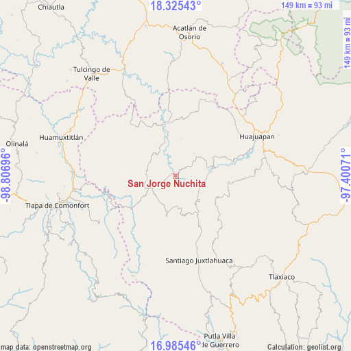
San Jorge Nuchita GPS coordinates[2]
17° 39' 24.084" North, 98° 6' 13.788" West
| Map corner | latitude | longitude |
|---|---|---|
| Upper-left | 18.32543°, | -98.80696° |
| Center: | 17.65669°, | -98.10383° |
| Lower-right: | 16.98546°, | -97.40071° |
| Map W x H: | 149×149 km | = 92.6×92.6mi |
| max Lat: | 32.7° ⇑81.7% North |
| San Jorge Nuchita: | 17.65669° |
| min Lat: | ⇓18.3% South 14.53588° |
| min Long | San Jorge Nuchi | max Long |
| -117.105° | -98.10383° | -86.73105° |
| W 62.4%⇐ | ⇒37.6% E |
Elevation
Elevation of San Jorge Nuchita is 1196 m = 3924 ft, and this is 57.7 m = 189 ft below average elevation for this country.
| Max E: |
3497 m = 11473 ft | 55% |
| Avg. | 1253.7 m = 4113 ft | |
| San Jorge Nuchita | 1196 m = 3924 ft | |
Min E: |
-1 m = -3 ft | 45% |
See also: Mexico elevation on elevation.city.
Geographical zone
San Jorge Nuchita is located in North Torrid zone (between Equator and Tropic of Cancer). Distance of this Northern Tropic circle is 642.7 km =399.4 mi to North.| Distance of | km | miles | from San Jorge Nuchita |
|---|---|---|---|
| North Pole | 8043.8 | 4998.2 | to North |
| Arctic Circle | 5437.9 | 3379 | to North |
| Tropic Cancer | 642.7 | 399.4 | to North |
| Equator | 1963.2 | 1219.9 | to South |


Nearby cities:
15 places around San Jorge Nuchita: (largest is in red/bold)
• Guadalupe Ramírez
13 km =8.1 mi,  330°
330°
• Guadalupe de Morelos
2.3 km =1.4 mi,  341°
341°
• Nicolás Hidalgo
14.7 km =9.1 mi, 343°
• San Agustín Atenango
11.1 km =6.9 mi,  117°
117°
• San Andrés Sabinillo
12.1 km =7.5 mi,  39°
39°
• San Jerónimo Nuchita
1.8 km =1.1 mi,  143°
143°
• San Lorenzo
2.2 km =1.4 mi,  308°
308°
• San Luis Morelia
12.8 km =8 mi,  293°
293°
• San Sebastián del Monte
9 km =5.6 mi,  74°
74°
• Santa Cruz de Bravo
15.2 km =9.4 mi,  236°
236°
• Santo Domingo Tonalá
14.8 km =9.2 mi,  82°
82°
• Santos Reyes Yucuna
17.2 km =10.7 mi, 39°
• Tamazola
12.5 km =7.8 mi,  276°
276°
• Yetla de Juárez
12 km =7.5 mi,  85°
85°
• Yucuyachi
11.2 km =7 mi, 241°
Sources, notices
• [Note1] Compared only with cities in Mexico existing in our database
• [Src1] Map data: © OpenStreetMap contributors (CC-BY-SA)
• [Src2] Other city data from geonames.org with taken over terms of usage.
• [Src3] Geographical zone / Annual Mean Temperature by Robert A. Rohde @ Wikipedia
