Guadalupe Ramírez geodata
Guadalupe Ramírez (Oaxaca) is a populated place; located in Mexico in America/Mexico_City (GMT-6) time zone. With population of 901 people, there are 9681 cities with bigger population in this country. Compared to other cities in Mexico, 80.9% of cities are located further ↑North; 61.7% of cities are located further ←West and 55.3% of cities have higher elevation than Guadalupe Ramírez. Note1


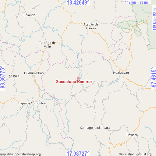
Guadalupe Ramírez GPS coordinates[2]
17° 45' 29.268" North, 98° 9' 52.632" West
| Map corner | latitude | longitude |
|---|---|---|
| Upper-left | 18.42649°, | -98.86775° |
| Center: | 17.75813°, | -98.16462° |
| Lower-right: | 17.08727°, | -97.4615° |
| Map W x H: | 148.9×148.9 km | = 92.5×92.5mi |
| max Lat: | 32.7° ⇑80.9% North |
| Guadalupe Ramírez: | 17.75813° |
| min Lat: | ⇓19.1% South 14.53588° |
| min Long | Guadalupe Ramí | max Long |
| -117.105° | -98.16462° | -86.73105° |
| W 61.7%⇐ | ⇒38.3% E |
Elevation
Elevation of Guadalupe Ramírez is 1187 m = 3894 ft, and this is 66.7 m = 219 ft below average elevation for this country.
| Max E: |
3497 m = 11473 ft | 55.3% |
| Avg. | 1253.7 m = 4113 ft | |
| Guadalupe Ramírez | 1187 m = 3894 ft | |
Min E: |
-1 m = -3 ft | 44.7% |
See also: Mexico elevation on elevation.city.
Geographical zone
Guadalupe Ramírez is located in North Torrid zone (between Equator and Tropic of Cancer). Distance of this Northern Tropic circle is 631.4 km =392.3 mi to North.| Distance of | km | miles | from Guadalupe Ramírez |
|---|---|---|---|
| North Pole | 8032.5 | 4991.2 | to North |
| Arctic Circle | 5426.7 | 3372 | to North |
| Tropic Cancer | 631.4 | 392.3 | to North |
| Equator | 1974.5 | 1226.9 | to South |


Nearby cities:
15 places around Guadalupe Ramírez: (largest is in red/bold)
• Guadalupe de Morelos
10.8 km =6.7 mi,  147°
147°
• Mariscala de Juárez
11.6 km =7.2 mi,  12°
12°
• Nicolás Hidalgo
3.5 km =2.2 mi,  38°
38°
• San Andrés Sabinillo
14.2 km =8.8 mi,  97°
97°
• San Jerónimo Nuchita
14.8 km =9.2 mi, 149°
• San Jorge Nuchita
13 km =8.1 mi, 150°
• San Juan Ihualtepec
13.3 km =8.3 mi,  261°
261°
• San Juan la Ciénega
16 km =9.9 mi,  310°
310°
• San Lorenzo
11 km =6.8 mi, 154°
• San Luis Morelia
8 km =5 mi,  220°
220°
• San Martín Zacatepec
12.3 km =7.6 mi,  63°
63°
• Santa Cruz Tacache de Mina
8 km =5 mi, 8°
• Santos Reyes Yucuna
17.4 km =10.8 mi,  83°
83°
• Tamazola
11.4 km =7.1 mi,  211°
211°
• Yucuyachi
17 km =10.6 mi,  191°
191°
Sources, notices
• [Note1] Compared only with cities in Mexico existing in our database
• [Src1] Map data: © OpenStreetMap contributors (CC-BY-SA)
• [Src2] Other city data from geonames.org with taken over terms of usage.
• [Src3] Geographical zone / Annual Mean Temperature by Robert A. Rohde @ Wikipedia
