Los Corrales geodata
Los Corrales (Oaxaca) is a populated place; located in Mexico in America/Mexico_City (GMT-6) time zone. With population of 588 people, there are 14598 cities with bigger population in this country. Compared to other cities in Mexico, 73.4% of cities are located further ↑North; 79% of cities are located further ←West and 79.9% of cities have higher elevation than Los Corrales. Note1


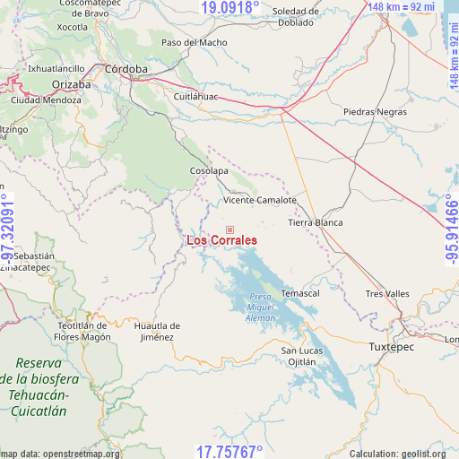
Los Corrales GPS coordinates[2]
18° 25' 33.708" North, 96° 37' 4.008" West
| Map corner | latitude | longitude |
|---|---|---|
| Upper-left | 19.0918°, | -97.32091° |
| Center: | 18.42603°, | -96.61778° |
| Lower-right: | 17.75767°, | -95.91466° |
| Map W x H: | 148.3×148.3 km | = 92.1×92.1mi |
| max Lat: | 32.7° ⇑73.4% North |
| Los Corrales: | 18.42603° |
| min Lat: | ⇓26.6% South 14.53588° |
| min Long | Los Corrales | max Long |
| -117.105° | -96.61778° | -86.73105° |
| W 79%⇐ | ⇒21% E |
Elevation
Elevation of Los Corrales is 96 m = 315 ft, and this is 1157.7 m = 3798 ft below average elevation for this country.
| Max E: |
3497 m = 11473 ft | 79.9% |
| Avg. | 1253.7 m = 4113 ft | |
| Los Corrales | 96 m = 315 ft | |
Min E: |
-1 m = -3 ft | 20.1% |
See also: Mexico elevation on elevation.city.
Geographical zone
Los Corrales is located in North Torrid zone (between Equator and Tropic of Cancer). Distance of this Northern Tropic circle is 557.1 km =346.2 mi to North.| Distance of | km | miles | from Los Corrales |
|---|---|---|---|
| North Pole | 7958.3 | 4945.1 | to North |
| Arctic Circle | 5352.4 | 3325.8 | to North |
| Tropic Cancer | 557.1 | 346.2 | to North |
| Equator | 2048.8 | 1273.1 | to South |


Nearby cities:
15 places around Los Corrales: (largest is in red/bold)
• Acatlán de Pérez Figueroa
12.7 km =7.9 mi,  5°
5°
• Arroyo de Enmedio
10.9 km =6.8 mi,  43°
43°
• Atlizacuapan
15.9 km =9.9 mi,  286°
286°
• Ixtacapa el Chico
15 km =9.3 mi,  298°
298°
• La Defensa
11.6 km =7.2 mi, 43°
• La Junta
8.4 km =5.2 mi,  330°
330°
• Las Josefinas
10.9 km =6.8 mi,  313°
313°
• Las Limas
12.7 km =7.9 mi, 297°
• Raya Caracol
9.4 km =5.8 mi,  238°
238°
• Río Lodo
15.8 km =9.8 mi,  205°
205°
• San Agustín del Palmar
14.8 km =9.2 mi, 312°
• Tembladera de la Selva 1
10.9 km =6.8 mi,  75°
75°
• Tembladera del Castillo
13 km =8.1 mi,  106°
106°
• Vicente Camalote
13.6 km =8.5 mi, 43°
• Zona Urbana Ejidal
12.2 km =7.6 mi, 14°
Sources, notices
• [Note1] Compared only with cities in Mexico existing in our database
• [Src1] Map data: © OpenStreetMap contributors (CC-BY-SA)
• [Src2] Other city data from geonames.org with taken over terms of usage.
• [Src3] Geographical zone / Annual Mean Temperature by Robert A. Rohde @ Wikipedia
