La Junta geodata
La Junta (Veracruz) is a populated place; located in Mexico in America/Mexico_City (GMT-6) time zone. With population of 1,014 people, there are 8595 cities with bigger population in this country. Compared to other cities in Mexico, 72.7% of cities are located further ↑North; 78.8% of cities are located further ←West and 79.1% of cities have higher elevation than La Junta. Note1


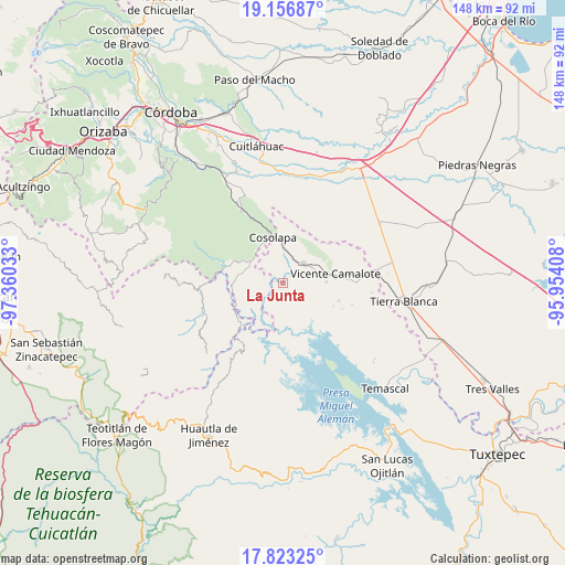
La Junta GPS coordinates[2]
18° 29' 28.896" North, 96° 39' 25.92" West
| Map corner | latitude | longitude |
|---|---|---|
| Upper-left | 19.15687°, | -97.36033° |
| Center: | 18.49136°, | -96.6572° |
| Lower-right: | 17.82325°, | -95.95408° |
| Map W x H: | 148.3×148.3 km | = 92.1×92.1mi |
| max Lat: | 32.7° ⇑72.7% North |
| La Junta: | 18.49136° |
| min Lat: | ⇓27.3% South 14.53588° |
| min Long | La Junta | max Long |
| -117.105° | -96.6572° | -86.73105° |
| W 78.8%⇐ | ⇒21.2% E |
Elevation
Elevation of La Junta is 109 m = 358 ft, and this is 1144.7 m = 3756 ft below average elevation for this country.
| Max E: |
3497 m = 11473 ft | 79.1% |
| Avg. | 1253.7 m = 4113 ft | |
| La Junta | 109 m = 358 ft | |
Min E: |
-1 m = -3 ft | 20.9% |
See also: Mexico elevation on elevation.city.
Geographical zone
La Junta is located in North Torrid zone (between Equator and Tropic of Cancer). Distance of this Northern Tropic circle is 549.9 km =341.7 mi to North.| Distance of | km | miles | from La Junta |
|---|---|---|---|
| North Pole | 7951 | 4940.5 | to North |
| Arctic Circle | 5345.1 | 3321.3 | to North |
| Tropic Cancer | 549.9 | 341.7 | to North |
| Equator | 2056 | 1277.5 | to South |


Nearby cities:
15 places around La Junta: (largest is in red/bold)
• Acatlán de Pérez Figueroa
7.6 km =4.7 mi,  45°
45°
• Almolonga
13 km =8.1 mi,  358°
358°
• Arroyo de Enmedio
11.6 km =7.2 mi,  86°
86°
• Atlizacuapan
11.4 km =7.1 mi,  255°
255°
• Cosolapa
12.5 km =7.8 mi,  346°
346°
• El Suspiro
13.1 km =8.1 mi, 257°
• Ixtacapa el Chico
9 km =5.6 mi,  269°
269°
• La Defensa
12.2 km =7.6 mi,  84°
84°
• Laguna Chica (Pueblo Nuevo)
9.8 km =6.1 mi,  305°
305°
• Las Josefinas
3.8 km =2.4 mi, 272°
• Las Limas
7.3 km =4.5 mi, 258°
• Los Corrales
8.4 km =5.2 mi,  150°
150°
• Raya Caracol
12.8 km =8 mi,  197°
197°
• San Agustín del Palmar
7.3 km =4.5 mi,  292°
292°
• Zona Urbana Ejidal
8.5 km =5.3 mi,  57°
57°
Sources, notices
• [Note1] Compared only with cities in Mexico existing in our database
• [Src1] Map data: © OpenStreetMap contributors (CC-BY-SA)
• [Src2] Other city data from geonames.org with taken over terms of usage.
• [Src3] Geographical zone / Annual Mean Temperature by Robert A. Rohde @ Wikipedia
