Vista Hermosa geodata
Vista Hermosa (Oaxaca) is a populated place; located in Mexico in America/Mexico_City (GMT-6) time zone. With population of 672 people, there are 12920 cities with bigger population in this country. Compared to other cities in Mexico, 78.3% of cities are located further ↑North; 80% of cities are located further ←West and 80.2% of cities have higher elevation than Vista Hermosa. Note1


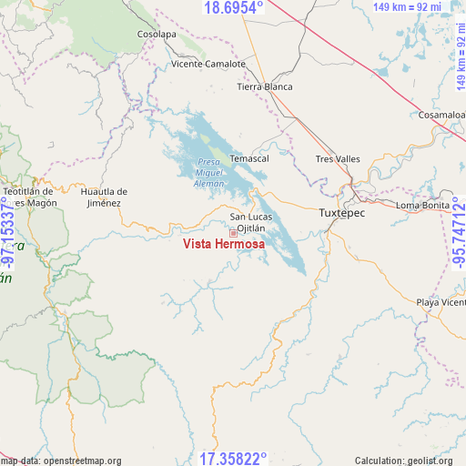
Vista Hermosa GPS coordinates[2]
18° 1' 41.088" North, 96° 27' 0.864" West
| Map corner | latitude | longitude |
|---|---|---|
| Upper-left | 18.6954°, | -97.15337° |
| Center: | 18.02808°, | -96.45024° |
| Lower-right: | 17.35822°, | -95.74712° |
| Map W x H: | 148.7×148.7 km | = 92.4×92.4mi |
| max Lat: | 32.7° ⇑78.3% North |
| Vista Hermosa: | 18.02808° |
| min Lat: | ⇓21.7% South 14.53588° |
| min Long | Vista Hermosa | max Long |
| -117.105° | -96.45024° | -86.73105° |
| W 80%⇐ | ⇒20% E |
Elevation
Elevation of Vista Hermosa is 92 m = 302 ft, and this is 1161.7 m = 3811 ft below average elevation for this country.
| Max E: |
3497 m = 11473 ft | 80.2% |
| Avg. | 1253.7 m = 4113 ft | |
| Vista Hermosa | 92 m = 302 ft | |
Min E: |
-1 m = -3 ft | 19.8% |
See also: Mexico elevation on elevation.city.
Geographical zone
Vista Hermosa is located in North Torrid zone (between Equator and Tropic of Cancer). Distance of this Northern Tropic circle is 601.4 km =373.7 mi to North.| Distance of | km | miles | from Vista Hermosa |
|---|---|---|---|
| North Pole | 8002.5 | 4972.5 | to North |
| Arctic Circle | 5396.6 | 3353.3 | to North |
| Tropic Cancer | 601.4 | 373.7 | to North |
| Equator | 2004.5 | 1245.5 | to South |


Nearby cities:
15 places around Vista Hermosa: (largest is in red/bold)
• Agua de Tierra (Sección la Montaña)
8.9 km =5.5 mi,  318°
318°
• Arroyo Camalote
8.2 km =5.1 mi,  33°
33°
• Arroyo Grande
9.4 km =5.8 mi,  327°
327°
• Arroyo Venado (Sección Tercera)
10.1 km =6.3 mi,  304°
304°
• Colonia la Central
9.5 km =5.9 mi,  313°
313°
• Flor Batavia
8.7 km =5.4 mi,  236°
236°
• La Permuta
8.5 km =5.3 mi, 331°
• Laguna Arroyo Grande
7.1 km =4.4 mi, 25°
• Loma de Cedro
1.9 km =1.2 mi,  275°
275°
• Loma de Piedra
7.8 km =4.8 mi,  8°
8°
• Playa Chica
8.1 km =5 mi, 297°
• Playa de Soyaltepec
9.7 km =6 mi,  21°
21°
• San Felipe Jalapa de Díaz
10.2 km =6.3 mi, 297°
• San Lucas Ojitlán
6.4 km =4 mi,  59°
59°
• Santo Tomás
6.9 km =4.3 mi, 282°
Sources, notices
• [Note1] Compared only with cities in Mexico existing in our database
• [Src1] Map data: © OpenStreetMap contributors (CC-BY-SA)
• [Src2] Other city data from geonames.org with taken over terms of usage.
• [Src3] Geographical zone / Annual Mean Temperature by Robert A. Rohde @ Wikipedia
