La Permuta geodata
La Permuta (Oaxaca) is a populated place; located in Mexico in America/Mexico_City (GMT-6) time zone. With population of 714 people, there are 12202 cities with bigger population in this country. Compared to other cities in Mexico, 77.6% of cities are located further ↑North; 79.8% of cities are located further ←West and 79.2% of cities have higher elevation than La Permuta. Note1


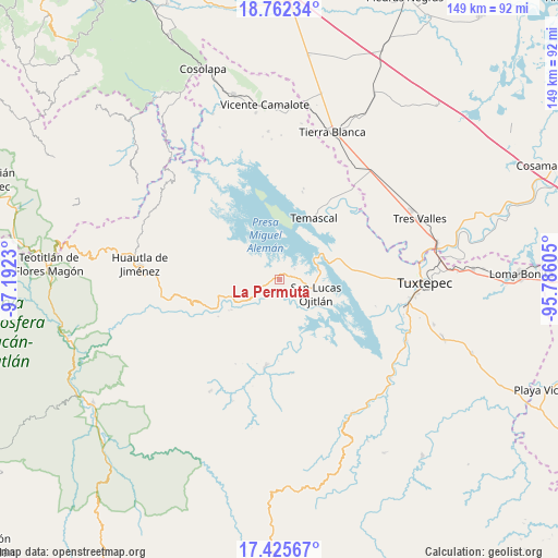
La Permuta GPS coordinates[2]
18° 5' 43.008" North, 96° 29' 21.012" West
| Map corner | latitude | longitude |
|---|---|---|
| Upper-left | 18.76234°, | -97.1923° |
| Center: | 18.09528°, | -96.48917° |
| Lower-right: | 17.42567°, | -95.78605° |
| Map W x H: | 148.6×148.6 km | = 92.3×92.3mi |
| max Lat: | 32.7° ⇑77.6% North |
| La Permuta: | 18.09528° |
| min Lat: | ⇓22.4% South 14.53588° |
| min Long | La Permuta | max Long |
| -117.105° | -96.48917° | -86.73105° |
| W 79.8%⇐ | ⇒20.2% E |
Elevation
Elevation of La Permuta is 108 m = 354 ft, and this is 1145.7 m = 3759 ft below average elevation for this country.
| Max E: |
3497 m = 11473 ft | 79.2% |
| Avg. | 1253.7 m = 4113 ft | |
| La Permuta | 108 m = 354 ft | |
Min E: |
-1 m = -3 ft | 20.8% |
See also: Mexico elevation on elevation.city.
Geographical zone
La Permuta is located in North Torrid zone (between Equator and Tropic of Cancer). Distance of this Northern Tropic circle is 593.9 km =369 mi to North.| Distance of | km | miles | from La Permuta |
|---|---|---|---|
| North Pole | 7995.1 | 4967.9 | to North |
| Arctic Circle | 5389.2 | 3348.7 | to North |
| Tropic Cancer | 593.9 | 369 | to North |
| Equator | 2012 | 1250.2 | to South |


Nearby cities:
15 places around La Permuta: (largest is in red/bold)
• Agua de Tierra (Sección la Montaña)
2 km =1.2 mi,  244°
244°
• Arroyo Grande
1 km =0.6 mi,  292°
292°
• Arroyo Venado (Sección Tercera)
4.5 km =2.8 mi,  247°
247°
• Arroyo Zapotillo
6.2 km =3.9 mi, 250°
• Benito Juárez II (San Martín)
5.8 km =3.6 mi,  30°
30°
• Camino de Ixcatlán
3.5 km =2.2 mi,  281°
281°
• Colonia la Central
3 km =1.9 mi, 251°
• Loma San Juan
5.9 km =3.7 mi, 275°
• Loma de Piedra
5.2 km =3.2 mi,  87°
87°
• Los Zarates
2.8 km =1.7 mi,  296°
296°
• Piedra de Amolar
4.9 km =3 mi,  55°
55°
• Playa Chica
4.9 km =3 mi,  219°
219°
• San Felipe Jalapa de Díaz
5.6 km =3.5 mi, 241°
• San Pedro Ixcatlán
6 km =3.7 mi,  339°
339°
• Sección los Roques
1.9 km =1.2 mi, 300°
Sources, notices
• [Note1] Compared only with cities in Mexico existing in our database
• [Src1] Map data: © OpenStreetMap contributors (CC-BY-SA)
• [Src2] Other city data from geonames.org with taken over terms of usage.
• [Src3] Geographical zone / Annual Mean Temperature by Robert A. Rohde @ Wikipedia
