San Andrés Yatumi geodata
San Andrés Yatumi (Oaxaca) is a populated place; located in Mexico in America/Mexico_City (GMT-6) time zone. With population of 588 people, there are 14598 cities with bigger population in this country. Compared to other cities in Mexico, 85.9% of cities are located further ↑North; 80.2% of cities are located further ←West and 85.9% of cities have lower elevation than San Andrés Yatumi. Note1


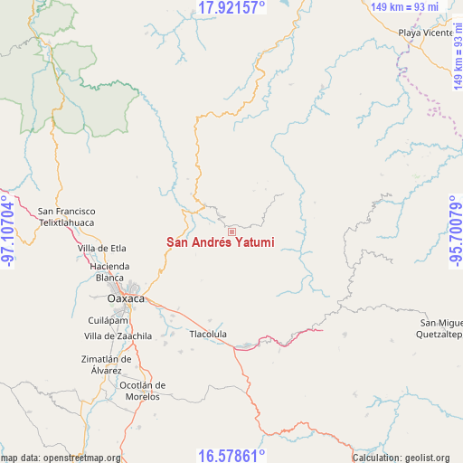
San Andrés Yatumi GPS coordinates[2]
17° 15' 4.716" North, 96° 24' 14.076" West
| Map corner | latitude | longitude |
|---|---|---|
| Upper-left | 17.92157°, | -97.10704° |
| Center: | 17.25131°, | -96.40391° |
| Lower-right: | 16.57861°, | -95.70079° |
| Map W x H: | 149.3×149.3 km | = 92.8×92.8mi |
| max Lat: | 32.7° ⇑85.9% North |
| San Andrés Yatumi: | 17.25131° |
| min Lat: | ⇓14.1% South 14.53588° |
| min Long | San Andrés Yat | max Long |
| -117.105° | -96.40391° | -86.73105° |
| W 80.2%⇐ | ⇒19.8% E |
Elevation
Elevation of San Andrés Yatumi is 2279 m = 7477 ft, and this is 1025.3 m = 3364 ft above average elevation for this country.
| Max E: |
3497 m = 11473 ft | 14.1% |
| San Andrés Yatumi | 2279 m 7477 ft | |
| Avg. | 1253.7 m = 4113 ft | |
Min E: |
-1 m = -3 ft | 85.9% |
See also: Mexico elevation on elevation.city.
Geographical zone
San Andrés Yatumi is located in North Torrid zone (between Equator and Tropic of Cancer). Distance of this Northern Tropic circle is 687.8 km =427.4 mi to North.| Distance of | km | miles | from San Andrés Yatumi |
|---|---|---|---|
| North Pole | 8088.9 | 5026.2 | to North |
| Arctic Circle | 5483 | 3407 | to North |
| Tropic Cancer | 687.8 | 427.4 | to North |
| Equator | 1918.2 | 1191.9 | to South |


Nearby cities:
15 places around San Andrés Yatumi: (largest is in red/bold)
• Cajonos
17.7 km =11 mi,  121°
121°
• Guelatao de Juárez
12.2 km =7.6 mi,  307°
307°
• Ixtlán de Juárez
12.7 km =7.9 mi,  315°
315°
• La Natividad
6 km =3.7 mi,  328°
328°
• La Trinidad de Ixtlán
2.3 km =1.4 mi, 319°
• San Antonio Cuajimoloyas
15.6 km =9.7 mi,  199°
199°
• San Juan Juquila Vijanos
15.6 km =9.7 mi,  43°
43°
• San Miguel Yotao
15 km =9.3 mi,  27°
27°
• Santa Catarina Ixtepeji
17.1 km =10.6 mi,  276°
276°
• Santa María Yavesía
3.3 km =2.1 mi,  237°
237°
• Santiago Laxopa
10.5 km =6.5 mi,  110°
110°
• Santiago Zoochila
17.5 km =10.9 mi,  101°
101°
• Tanetze de Zaragoza
17.7 km =11 mi, 38°
• Yalina
15.1 km =9.4 mi,  94°
94°
• Zoogocho
17.1 km =10.6 mi, 94°
Sources, notices
• [Note1] Compared only with cities in Mexico existing in our database
• [Src1] Map data: © OpenStreetMap contributors (CC-BY-SA)
• [Src2] Other city data from geonames.org with taken over terms of usage.
• [Src3] Geographical zone / Annual Mean Temperature by Robert A. Rohde @ Wikipedia
