San Antonio Cuajimoloyas geodata
San Antonio Cuajimoloyas (Oaxaca) is a populated place; located in Mexico in America/Mexico_City (GMT-6) time zone. With population of 694 people, there are 12543 cities with bigger population in this country. Compared to other cities in Mexico, 87.5% of cities are located further ↑North; 80% of cities are located further ←West and 100% of cities have lower elevation than San Antonio Cuajimoloyas. Note1
Current local time in San Antonio Cuajimoloyas:
08:32 AM, WednesdayDifference from your time zone: hours


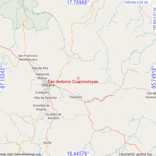
San Antonio Cuajimoloyas GPS coordinates[2]
17° 7' 8.148" North, 96° 27' 8.28" West
| Map corner | latitude | longitude |
|---|---|---|
| Upper-left | 17.78968°, | -97.15543° |
| Center: | 17.11893°, | -96.4523° |
| Lower-right: | 16.44576°, | -95.74918° |
| Map W x H: | 149.4×149.4 km | = 92.8×92.8mi |
| max Lat: | 32.7° ⇑87.5% North |
| San Antonio Cuajimoloyas: | 17.11893° |
| min Lat: | ⇓12.5% South 14.53588° |
| min Long | San Antonio Cua | max Long |
| -117.105° | -96.4523° | -86.73105° |
| W 80%⇐ | ⇒20% E |
Elevation
Elevation of San Antonio Cuajimoloyas is 3168 m = 10394 ft, and this is 1914.3 m = 6281 ft above average elevation for this country.
| Max E: |
3497 m = 11473 ft | 0% |
| San Antonio Cuajimoloyas | 3168 m 10394 ft | |
| Avg. | 1253.7 m = 4113 ft | |
Min E: |
-1 m = -3 ft | 100% |
See also: Mexico elevation on elevation.city.
Geographical zone
San Antonio Cuajimoloyas is located in North Torrid zone (between Equator and Tropic of Cancer). Distance of this Northern Tropic circle is 702.5 km =436.5 mi to North.| Distance of | km | miles | from San Antonio Cuajimoloyas |
|---|---|---|---|
| North Pole | 8103.6 | 5035.3 | to North |
| Arctic Circle | 5497.7 | 3416.1 | to North |
| Tropic Cancer | 702.5 | 436.5 | to North |
| Equator | 1903.4 | 1182.7 | to South |


Nearby cities:
15 places around San Antonio Cuajimoloyas: (largest is in red/bold)
• El Punto
17.8 km =11.1 mi,  307°
307°
• Fraccionamiento Ciudad Yagul
15.8 km =9.8 mi,  183°
183°
• Fraccionamiento Rancho Valle del Lago
17.1 km =10.6 mi,  198°
198°
• La Trinidad de Ixtlán
16.9 km =10.5 mi,  12°
12°
• Macuilxóchitl de Artigas Carranza
14.8 km =9.2 mi,  219°
219°
• San Andrés Yatumi
15.6 km =9.7 mi,  19°
19°
• San Jerónimo Tlacochahuaya
18.5 km =11.5 mi,  228°
228°
• San Miguel del Valle
11.5 km =7.1 mi,  161°
161°
• Santa Ana del Valle
13.9 km =8.6 mi,  188°
188°
• Santa María Yavesía
13.1 km =8.1 mi, 10°
• Santiago Ixtaltepec
15.7 km =9.8 mi, 230°
• Santiago Laxopa
18.6 km =11.6 mi,  53°
53°
• Teotitlán del Valle
12.2 km =7.6 mi, 215°
• Tlacolula de Matamoros
18.4 km =11.4 mi, 187°
• Villa Díaz Ordaz
13.9 km =8.6 mi,  171°
171°
Sources, notices
• [Note1] Compared only with cities in Mexico existing in our database
• [Src1] Map data: © OpenStreetMap contributors (CC-BY-SA)
• [Src2] Other city data from geonames.org with taken over terms of usage.
• [Src3] Geographical zone / Annual Mean Temperature by Robert A. Rohde @ Wikipedia
