San Jacinto Amilpas geodata
San Jacinto Amilpas (Oaxaca) is a populated place; located in Mexico in America/Mexico_City (GMT-6) time zone. With population of 13,860 people, there are 700 cities with bigger population in this country. Compared to other cities in Mexico, 87.6% of cities are located further ↑North; 77.8% of cities are located further ←West and 54% of cities have lower elevation than San Jacinto Amilpas. Note1


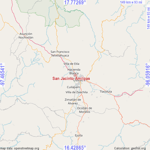
San Jacinto Amilpas GPS coordinates[2]
17° 6' 6.768" North, 96° 45' 44.208" West
| Map corner | latitude | longitude |
|---|---|---|
| Upper-left | 17.77269°, | -97.46541° |
| Center: | 17.10188°, | -96.76228° |
| Lower-right: | 16.42865°, | -96.05916° |
| Map W x H: | 149.4×149.4 km | = 92.8×92.8mi |
| max Lat: | 32.7° ⇑87.6% North |
| San Jacinto Amilpas: | 17.10188° |
| min Lat: | ⇓12.4% South 14.53588° |
| min Long | San Jacinto Ami | max Long |
| -117.105° | -96.76228° | -86.73105° |
| W 77.8%⇐ | ⇒22.2% E |
Elevation
Elevation of San Jacinto Amilpas is 1562 m = 5125 ft, and this is 308.3 m = 1011 ft above average elevation for this country.
| Max E: |
3497 m = 11473 ft | 46% |
| San Jacinto Amilpas | 1562 m 5125 ft | |
| Avg. | 1253.7 m = 4113 ft | |
Min E: |
-1 m = -3 ft | 54% |
See also: Mexico elevation on elevation.city.
Geographical zone
San Jacinto Amilpas is located in North Torrid zone (between Equator and Tropic of Cancer). Distance of this Northern Tropic circle is 704.4 km =437.7 mi to North.| Distance of | km | miles | from San Jacinto Amilpas |
|---|---|---|---|
| North Pole | 8105.5 | 5036.5 | to North |
| Arctic Circle | 5499.6 | 3417.3 | to North |
| Tropic Cancer | 704.4 | 437.7 | to North |
| Equator | 1901.6 | 1181.6 | to South |


Nearby cities:
15 places around San Jacinto Amilpas: (largest is in red/bold)
• Barrio Morelos
4.3 km =2.7 mi,  344°
344°
• Fraccionamiento Real Santa María
3.7 km =2.3 mi,  298°
298°
• Fraccionamiento Riberas de San Jerónimo
2 km =1.2 mi,  306°
306°
• Hacienda Blanca
4.5 km =2.8 mi, 341°
• La Cañada
3.9 km =2.4 mi,  205°
205°
• Loma Bonita (Paraje Jagüey)
5 km =3.1 mi, 214°
• Oaxaca
5.8 km =3.6 mi,  134°
134°
• Poblado Morelos
5.7 km =3.5 mi,  345°
345°
• San Jerónimo Yahuiche
1.1 km =0.7 mi, 313°
• San Lorenzo Cacaotepec
5.1 km =3.2 mi, 303°
• San Pablo Etla
4.9 km =3 mi,  17°
17°
• San Pedro Ixtlahuaca
7.3 km =4.5 mi,  234°
234°
• Santa María Atzompa
1.5 km =0.9 mi,  269°
269°
• Santiago Etla
6.3 km =3.9 mi,  332°
332°
• Trinidad de Viguera
3.4 km =2.1 mi, 21°
Sources, notices
• [Note1] Compared only with cities in Mexico existing in our database
• [Src1] Map data: © OpenStreetMap contributors (CC-BY-SA)
• [Src2] Other city data from geonames.org with taken over terms of usage.
• [Src3] Geographical zone / Annual Mean Temperature by Robert A. Rohde @ Wikipedia
