San Lorenzo Cacaotepec geodata
San Lorenzo Cacaotepec (Oaxaca) is a populated place; located in Mexico in America/Mexico_City (GMT-6) time zone. With population of 7,351 people, there are 1261 cities with bigger population in this country. Compared to other cities in Mexico, 87.4% of cities are located further ↑North; 77.2% of cities are located further ←West and 55.8% of cities have lower elevation than San Lorenzo Cacaotepec. Note1
Current local time in San Lorenzo Cacaotepec:
06:54 AM, WednesdayDifference from your time zone: hours


San Lorenzo Cacaotepec GPS coordinates[2]
17° 7' 39.864" North, 96° 48' 8.784" West
| Map corner | latitude | longitude |
|---|---|---|
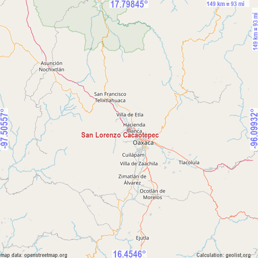
| Upper-left | 17.79845°, | -97.50557° |
| Center: | 17.12774°, | -96.80244° |
| Lower-right: | 16.4546°, | -96.09932° |
| Map W x H: | 149.4×149.4 km | = 92.8×92.8mi |
| max Lat: | 32.7° ⇑87.4% North |
| San Lorenzo Cacaotepec: | 17.12774° |
| min Lat: | ⇓12.6% South 14.53588° |
| min Long | San Lorenzo Cac | max Long |
| -117.105° | -96.80244° | -86.73105° |
| W 77.2%⇐ | ⇒22.8% E |
Elevation
Elevation of San Lorenzo Cacaotepec is 1611 m = 5285 ft, and this is 357.3 m = 1172 ft above average elevation for this country.
| Max E: |
3497 m = 11473 ft | 44.2% |
| San Lorenzo Cacaotepec | 1611 m 5285 ft | |
| Avg. | 1253.7 m = 4113 ft | |
Min E: |
-1 m = -3 ft | 55.8% |
See also: Mexico elevation on elevation.city.
Geographical zone
San Lorenzo Cacaotepec is located in North Torrid zone (between Equator and Tropic of Cancer). Distance of this Northern Tropic circle is 701.5 km =435.9 mi to North.| Distance of | km | miles | from San Lorenzo Cacaotepec |
|---|---|---|---|
| North Pole | 8102.6 | 5034.7 | to North |
| Arctic Circle | 5496.7 | 3415.5 | to North |
| Tropic Cancer | 701.5 | 435.9 | to North |
| Equator | 1904.4 | 1183.3 | to South |


Nearby cities:
15 places around San Lorenzo Cacaotepec: (largest is in red/bold)
• Barrio Morelos
3.4 km =2.1 mi,  68°
68°
• Fraccionamiento Real Santa María
1.5 km =0.9 mi,  136°
136°
• Fraccionamiento Riberas de San Jerónimo
3.2 km =2 mi,  122°
122°
• Guadalupe Etla
5.1 km =3.2 mi,  350°
350°
• Guadalupe Hidalgo
2.6 km =1.6 mi,  339°
339°
• Hacienda Blanca
3.1 km =1.9 mi,  64°
64°
• Matadamas
3.9 km =2.4 mi, 336°
• Poblado Morelos
3.9 km =2.4 mi,  47°
47°
• San Felipe Tejalápam
5.8 km =3.6 mi,  251°
251°
• San Jacinto Amilpas
5.1 km =3.2 mi, 123°
• San Jerónimo Yahuiche
4.1 km =2.5 mi, 121°
• San Sebastián Etla
4.5 km =2.8 mi,  26°
26°
• Santa María Atzompa
4 km =2.5 mi, 136°
• Santiago Etla
3.1 km =1.9 mi, 26°
• Trinidad de Viguera
5.6 km =3.5 mi,  86°
86°
Sources, notices
• [Note1] Compared only with cities in Mexico existing in our database
• [Src1] Map data: © OpenStreetMap contributors (CC-BY-SA)
• [Src2] Other city data from geonames.org with taken over terms of usage.
• [Src3] Geographical zone / Annual Mean Temperature by Robert A. Rohde @ Wikipedia
