Hacienda Blanca geodata
Hacienda Blanca (Oaxaca) is a populated place; located in Mexico in America/Mexico_City (GMT-6) time zone. With population of 7,758 people, there are 1200 cities with bigger population in this country. Compared to other cities in Mexico, 87.2% of cities are located further ↑North; 77.6% of cities are located further ←West and 55.2% of cities have lower elevation than Hacienda Blanca. Note1


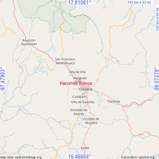
Hacienda Blanca GPS coordinates[2]
17° 8' 23.784" North, 96° 46' 33.24" West
| Map corner | latitude | longitude |
|---|---|---|
| Upper-left | 17.81061°, | -97.47903° |
| Center: | 17.13994°, | -96.7759° |
| Lower-right: | 16.46684°, | -96.07278° |
| Map W x H: | 149.4×149.4 km | = 92.8×92.8mi |
| max Lat: | 32.7° ⇑87.2% North |
| Hacienda Blanca: | 17.13994° |
| min Lat: | ⇓12.8% South 14.53588° |
| min Long | Hacienda Blanca | max Long |
| -117.105° | -96.7759° | -86.73105° |
| W 77.6%⇐ | ⇒22.4% E |
Elevation
Elevation of Hacienda Blanca is 1592 m = 5223 ft, and this is 338.3 m = 1110 ft above average elevation for this country.
| Max E: |
3497 m = 11473 ft | 44.8% |
| Hacienda Blanca | 1592 m 5223 ft | |
| Avg. | 1253.7 m = 4113 ft | |
Min E: |
-1 m = -3 ft | 55.2% |
See also: Mexico elevation on elevation.city.
Geographical zone
Hacienda Blanca is located in North Torrid zone (between Equator and Tropic of Cancer). Distance of this Northern Tropic circle is 700.1 km =435 mi to North.| Distance of | km | miles | from Hacienda Blanca |
|---|---|---|---|
| North Pole | 8101.3 | 5033.9 | to North |
| Arctic Circle | 5495.4 | 3414.7 | to North |
| Tropic Cancer | 700.1 | 435 | to North |
| Equator | 1905.8 | 1184.2 | to South |


Nearby cities:
15 places around Hacienda Blanca: (largest is in red/bold)
• Barrio Morelos
0.3 km =0.2 mi,  111°
111°
• Fraccionamiento Real Santa María
3 km =1.9 mi,  215°
215°
• Fraccionamiento Riberas de San Jerónimo
3.1 km =1.9 mi,  182°
182°
• Guadalupe Etla
5.2 km =3.2 mi,  314°
314°
• Guadalupe Hidalgo
3.9 km =2.4 mi,  285°
285°
• Matadamas
4.9 km =3 mi,  297°
297°
• Poblado Morelos
1.3 km =0.8 mi,  2°
2°
• San Jacinto Amilpas
4.5 km =2.8 mi,  161°
161°
• San Jerónimo Yahuiche
3.5 km =2.2 mi,  169°
169°
• San Lorenzo Cacaotepec
3.1 km =1.9 mi,  244°
244°
• San Pablo Etla
3 km =1.9 mi,  81°
81°
• San Sebastián Etla
2.8 km =1.7 mi,  343°
343°
• Santa María Atzompa
4.3 km =2.7 mi, 181°
• Santiago Etla
2 km =1.2 mi, 313°
• Trinidad de Viguera
2.9 km =1.8 mi, 110°
Sources, notices
• [Note1] Compared only with cities in Mexico existing in our database
• [Src1] Map data: © OpenStreetMap contributors (CC-BY-SA)
• [Src2] Other city data from geonames.org with taken over terms of usage.
• [Src3] Geographical zone / Annual Mean Temperature by Robert A. Rohde @ Wikipedia
